Saturday, December 29, 2007

Return to Boyer Cabin

12/29/07

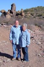
We've wanted to go back to the old Boyer Cabin once the temperatures cooled off, the last time we were there was in the summertime and the snakes were still very active. Boyer Cabin is a pretty site, very rustic. The beautifully built corrals are still standing, along with the cabin, bunkhouse and barn, all shaded by a large grove of native Sycamore and Holly trees. It was once owned by Tom Boyer, one of the active participants in the Pleasant Valley Wars, 1882-1892, a murderous feud between sheepherders and cattlemen.

We took some time today to dig through the old dump behind the main cabin. Trash disposal must have been quite a problem back in pioneer days, so most trash was dumped outside the back door, often into a stream bed. Anyway, we didn't take a lot of time to dig, so there's still a lot to be checked out. We found the usual items, old cans, broken bottles, shoes, not much intact except an old glass doorknob. We also found a mule shoe behind the barn and Larry & Jean found a couple of horseshoes. Something else to add to our collective collections. We've noticed that people who live out in the desert as we do, often collect little "treasures" bringing them home as souvenirs of our explorations. Most of the things we find, we place in our cactus garden, to add an authentic rustic touch.

The road up through Thompson Mesa was extremely muddy, but fortunately, the road is rocky enough so we didn't have much problem with the Jeeps slipping in the mud.
It was a nice run, there seldom is a run that isn't good. We feel fortunate to have it all within such close proximity to home.

Thursday, December 27, 2007

Sunflower Mine Trail

 12/27/07
It's cold and crisp here in Arizona, great Jeeping weather! We headed out this morning, destination, Sunflower Mine. The trail began as a nice Jeep trail, easy for a stock Jeep, however, it quickly changed from an easy trail, to a grip your seat, maneuver the rocks, cross the river, hell of a Jeep ride!  The previous time we'd visited the area, the riverbed was dry, exposing the rocks and daring us to cross. On this trip however, the river was running, hiding the rocks beneath the current. We managed to cross the river carefully, with no problems...all the while thinking that once this obstacle had been crossed that the rest of the trail would be a snap. WRONG! Just past the river we came upon an area that had been washed out from previous monsoon rains, all that remained of the trail were rocks, and more rocks. Ralph & Larry carefully chose the line they'd take and proceeded to  head up the trail...whew...we made it, no damage to anything but our nerves. After further meandering and maneuvering, we were within sight of the old refinery. Parking on a hill above the refinery area, we proceeded to hike the 1/4 mile down into the canyon to reach the ruins.
Sunflower mine was a large Cinnabar mining operation. Cinnabar when processed, produces Mercury a necessary ingredient when mining for gold. The mines operated from 1911 up until 1982, with most of the production taking place before the 1960s. The old refinery is still standing, though much of it has been reclaimed by Mother Nature, you can still get a good idea of what an extensive operation it once was. 
We checked out the refinery area, marveling at how massive it was and wondering how in the world the equipment and supplies were hauled into this remote location.
We didn't have time to check out the numerous mine shafts in the area since we all had dogs at home waiting for us. (canine guilt trips) I found this site however, if you're interested, you can take a virtual tour of the interiors of the mine tunnels. It's quite impressive to see how large an operation this once was. Sunflower Mine 1 - IronMiners.com  (hit your "back" button to return to this journal)
We had no problems on the way out, and we all breathed a sigh of relief after our mission was accomplished.
It's nice to be home, the fire is crackling, dinner is on the stove and all's well in our world.

Sunday, December 16, 2007

Not a single beep from the metal detector

12/16/07
We'd been told there might be the remnants of an old ranch and some houses atop a mesa near Livingston, Arizona. Livingston was a small town that existed between 1896 and 1907. We've fully explored the old Livingston site, finding very few remains, so we were interested in finding more information if possible about this now bygone town.
We headed out this morning, armed with the metal detector, digging implements and enthusiasm.
It was a nice hike, the temperature was perfect, staying right around 50º with full sunshine. We headed up a muddy wash to a mesa where we thought might be a promising place to begin our search. As we climbed up out of the wash, we noticed the ground was littered with rocks, of every kind imaginable. Seeing rocks isn't unusual, but something about these just didn't look natural. There were clearings, then piles of rock and then whole areas devoid of any rocks at all. The land was pristine, no signs of modern man anywhere.  We came to an area where the rocks had been laid out in patterns, squares, circles, and rectangles. We thought at first these might be the foundations left from the old home sites we were looking for, so we began metal detecting the area. Usually, as we sweep an area, we'll come across, a nail, a piece of wire, a bottle cap, something left behind, but this time, the detector showed nothing at all, unusual for a site where recent man once occupied the space.  As we continued looking, we noticed a white shape sticking up out of the soil. It turned out to be a piece of Indian pottery, you can still see the design painted on it. We decided to check further and eventually we came across a bronze marker, "Arizona State University, Archaeological, Datum 12, 1990." We'd stumbled upon an archaeological dig. The stones laid out in squares, circles and rectangles were the remains of Ancient Indian dwellings and the site had been examined and recorded by A.S.U in 1990.  We're not sure who the Indians were, probably Salado or Anasazi, farming tribes who inhabited the area 700 to 1000 years ago.
We went further up into the mountains and found several areas where we could make out the remains of an old mule trail, leading to various diggings, probably an old prospector had come along to see if there was any gold in the area. We didn't find the old ranch or houses we were looking for, but it was rewarding to find the Indian ruins. I'm sure we'll head back to the area to search further, there's no end to the discoveries we can make.

Thursday, December 13, 2007

As I am now, so shall you be...

12/13/07

Remember me, as you walk by
As you are now, so once was I.
As I am now, so shall you be
Remember this, and follow me.
*
To follow you, I'll not consent 
Until I know, which way you went.
 
 
Finally the rains have stopped, leaving everything bright and clear. The temperature this morning was a perfect 45º. We headed to the Tonto Ranger's Station to buy a wood cutting permit so we can take firewood from the National Forest. We always enjoy chatting with our knowledgeable local Forest Rangers and looking around at the exhibits and gift shop at the visitor's center. The gift shop is a great resource for books about local history.
Since the roads are still a bit too muddy to do much back road exploring, we decided to take a walk up to the old Roosevelt Cemetery. The cemetery was establish during the building of Roosevelt Dam between 1903 to 1911 as a final resting place for workers killed during the dam construction as well as early local residents of the Roosevelt area. The cemetery is located in a pretty spot on a hillside overlooking Roosevelt Lake, only about a mile from the dam.
One cannot help but wonder about the men who toiled so hard and gave up their lives to eke out a living in such a treacherous place during the dam construction. Most graves now are only marked by wooden crosses, a few have carved tombstones indicating that they were stone masons who actually cut the stone used in the dam construction. There are very few graves identified with names, although 75 people are buried there.
It is estimated that at least 10 men were killed during construction of RooseveltDambut these figures may not be accurate since death records did not include Mexican or Indian workers.
There are several hiking trails leading off into the Superstitions, but we'll reserve them to return another day.


Tuesday, December 11, 2007

A very wet desert

12/11/07

Well, no Jeeping to report. We've had several days of very heavy rain keeping us indoors and in front of the fire. We need the rain badly, but enough is enough. We're getting cabin fever and a severe case of bumpy road withdrawal.
Here are just a few pictures of Pinto Creek near our house. Normally it's a dry wash but the recent rains have turned it into a raging river.
It's quiet here right now, the rains have begun to subside a bit. Ralph's been called for jury duty so he had to go into town early this morning. The pooch and I are wandering aimlessly from room to room without anything to do, neither one of us likes to be separated from Ralph. It seems no matter where you live, even out here in the boondocks, when duty calls, you have to answer the call....haven't they ever heard of retirement?
Ah well, tomorrow is another day bringing with it (hopefully) sunny skies. The back roads will be a muddy mess, but with a bit of luck and some winds to dry them out, perhaps it won't be too long before we can hit the trail again.
 
I just went outside to check the mail and noticed the clouds lifting in the Sierra Anchas, revealing a blanket of snow. Very Pretty!


Sunday, November 25, 2007

Cherry Creek Asbestos Mining Operations

11/25/07
This morning we returned to the Asbestos Mine workings we'd passed yesterday on Cherry Creek Road. Jean and Larry were going to go with us this morning, but Murphy's Law came into play when were following behind them in our Jeep and noticed something hanging from beneath their Jeep. We called ahead to them on the radio and they pulled over to check. Unfortunately, it turned out to be a shock absorber hanging loose, one of the brackets holding it had broken. Since this wasn't going to be an easy trail fix, they had to turn back. We missed you guys!
Ralph & I decided to go on and make the trip. It was a fabulous morning, clear, crisp and cold, just the way we like it. We stopped just below Board Tree Saddle to take a photo of the mine off in the distance. We could also see a road that once ran from the top of the mountain, straight on down to the mine. It might have been used at one time to run a cable to haul ore carts up the mountainside. It would have been too steep for any kind of motor vehicle traffic, but possibly a mule could have made the trek.  
We parked the Jeep at the bottom of the mountain where the mines and workings are located and hiked up the steep trail leading to the mine works. Chunks of asbestos littered the entire area. Asbestos tailings were cascading down the steep hillsides. The ruins of the old mining site were quite extensive, mostly old boards, iron girders and heavy iron beams. There were a few rusted pieces of equipment left near the mining site. As best as we can tell by research, the mines were last in operation in the 1950s. We could see huge blocks of Asbestos still remaining in the mountainside. The walls of the workings were even made from Asbestos blocks, cut to fit and used to hold up the walls of the structures. After exploring the remains, we took a trail leading along a narrow ledge on the side of the mountain just past the workings and came across several mine adits. Since we weren't expecting to see actual tunnels, we didn't have our flashlights with us, so we only went into the tunnels a short distance. Even treading carefully, we could see Asbestos dust and fibers floating in the air inside the mine shafts. It's hard to imagine working in that environment all day long, every day.
Hiking up what was left of the road past the mines, we could see the road we'd spotted earlier from up near Board Tree Saddle. There were more piles of tailings and more Asbestos deposits, but we didn't explore any further today, we'll save that for another trip when we return with Jean & Larry & flashlights.
The peaceful shady glades along the trail were beautiful this morning. As we ate our sandwiches, we enjoyed the natural surroundings. Sunlight filtered through the trees, making dappled patterns on the rocky terrain. Cold mountain breezes were whispering through the pines...I know that sounds a bit trite, but the sound of the pine trees is truly a whisper. If we're really quiet and still, perhaps they'll whisper their secrets.  

Saturday, November 24, 2007

Cherry Creek Road completed.

 11/24/07
We headed out early this morning to meet Jean & Larry up near Workman Creek. They had gone out well before daylight, hoping to see some Elk as they came to feed at an apple orchard up near Aztec Peak. We didn't want to leave quite that early since we were obligated to take care of Bailey, (our Schnauzer boss) before we left the house. Larry & Jean didn't have any luck spotting Elk, better luck next time. Eventually, we're bound to see them, everyone tells us they're there, although I think they're probably mythical creatures, like Unicorns and Big Foot.
After meeting up with Jean & Larry, we headed to Young to take Cherry Creek Road all the way to Board Tree Saddle. We've done the other half of Cherry Creek Road, beginning from SR 288 and coming out at Board Tree Saddle, but we've never been on the other half of the trail.
Jean & I had to humor our husbands as they played hide and seek Jeep. Larry was leading, then he pulled off the road and hid Old Blue behind some bushes....then it was Ralph's turn, as we saw Old Blue pull up behind us, Ralph sped up until he too could pull off the road and hide our Old Peep's Jeep from Larry. It worked, we saw them go speeding past our hiding place. After wondering where each other was for a few minutes, we eventually met up at FR 54, to begin our trip on Cherry Creek Road. I'm convinced, boys will be boys, now and forever.
The trail headed out through a diverse landscape, from rolling meadows and pastures to steep hillsides, sheer cliffs and deep canyons. The scenery was ever-changing, and ever beautiful.
We stopped along the way to check out what appeared to be an old Asbestos mill. There wasn't much left but we could still see the remnants of the mill along with an assayer's office and some housing. Larry found some hard rock core samples near the old assayers office. We always find it interesting to speculate about the people who once worked in these places. It had to be terribly hard work, and certainly a very unhealthy environment to work in. From what we've read, Asbestos miners didn't live to a ripe old age, often developing a variety of deadly lung ailments.
We crossed Cherry Creek and found a beautiful spot right next to the creek that we all agreed would be a perfect camp site, so we'll certainly make future plans to return and spend a night or two.
We also spotted another much larger Asbestos operation up on a hillside, but since we were nearing the end of our trip and Board Tree Saddle, we didn't have time today to check it out.  We're hoping to head back, possibly tomorrow to explore it. It looks like an interesting place. Now we can say we've run Cherry Creek Road in its entirety, quite and accomplishment for all of us. It was another great run and a nice day spent in the company of good friends. Now if Jean and I can figure out how to keep the "boys" from playing hide and seek Jeep, all will be well.


Monday, November 19, 2007

Who needs a night light, we've got each other.

 11/19/07
We returned to the Workman Creek area to check out some more abandoned Uranium Mines, the Lucky Stop and the Hope Mining Claims. It was a nice hike through the pine forest to reach the mines. As we approached them, there was a distinctive odor of rotten eggs in the air, not a good sign. The odor is caused by  Hydrogen Sulphide, a gas that forms when ground water and sulphides are present in mines and caves...BAD AIR!  We knew not to take any chances with bad air, so we just went far enough in to take some quick photos and got out. They're a spooky looking group of mines, one of them has a vertical shaft dropping to unknown depths about twenty-five feet in from the main adit. The walls are a sickly yellow green color with white crystals forming along the way from water seepage. No bats were seen clinging to the ceilings, also not a good sign. We could see that there had been lots of digging in the surrounding area and we've read that there were at least 17 mines and claims in the Workman Creek group of mines. There were no timber supports to be found anywhere, all the mines had been carved into layered shale-type rock, an engineering marvel to see. The tunnels were mostly square, unlike the rounded tunnels we've seen in other mines, probably because the rock they were carved into seemed to fracture into squares naturally.  
We checked out another road on the way home, FR488, it heads out toward some really deep canyon drop-offs and rocky cliffs, I wasn't feeling particularly adventurous given the deep chasms and soaring heights, so we called it a day and headed home. 
After visiting the Uranium Mines, we'll probably glow in the dark, ah well, who needs night lights, we've got each other. 


Saturday, November 17, 2007

Aztec Peak and more

11/17/07
Awesome, fantastic, spectacular, serene, beautiful .... it's hard to find adjectives to describe the area we visited today. The road we took runs high up into the Sierra Ancha Mountains, bordering on the Sierra Ancha Wilderness. Riding up the road early this morning was a treat for the senses. Cool. crisp, pine scented air, sunlight filtering through the trees, dappling the road in front of us. 
On the way up, we paused to take some pictures of an abandoned Uranium mine. Uranium was heavily mined in the area up until the late 1950s. The adit was boarded up, with warning signs posted, but we managed to squeeze the camera through an opening to take a few photos. Supposedly, the surrounding areas are fairly radioactive, so overnight camping is prohibited. (we can't help but wonder if the local critters glow in the dark at night.)   
We stopped further up, to check out the waterfall, unfortunately, there hasn't been a lot of rain recently, so Workman Creek wasn't flowing full force as it toppled over the falls, falling to a depth of about 200 feet. Near the falls but high above are the remains of some ancient Indian cliff dwellings, but the climb looked to be one that you'd want some special equipment to make. Slippery shale slopes aren't for the casual climber...hmmm say THAT three times fast....
Proceeding up the road, we stopped at an old CCC (Civilian Conservation Corps) fish hatchery, a pretty spot where we could hear water meandering down the rocky creek below.
Our next stop was at the top of Aztec Peak. The fire tower up there is listed in the National Historic Lookout Register. The views from all sides were absolutely breathtaking. Aztec Peak's elevation is 7748 feet, making it the highest point in the Tonto National Forest. Just below the tower is a beautiful vantage point, someone, perhaps a bored fire tower lookout person has made what the locals call, Flintstones' living room. There are easy chairs, a table and chairs, a fireplace, all made from stacking flat sandstone rocks. It's quite a sight to see. The Coon Creek Fire which burned 9644 acres back in 2000 burned many of the large pine trees in the area, their remains can still be seen. Mother Nature has a way of healing her forests, so you can also see the new growth of young pine trees throughout the area. 
On our way back down the mountain, we made a stop at the old Murphy Ranch, now Haldi Ranch Apple Orchard. The log home and cabins are beautifully rustic, but the orchard looked like it had seen better days. 
The trip was perfect, thanks Larry & Jean for showing us such a beautiful spot. 


Friday, November 16, 2007

Dam it!

11/16/07

We decided on a bit of a walk today to explore the immediate area around Roosevelt Dam. Perfect weather, clear skies and temperature right at 60º made for great walking. Roosevelt Dam is quite an impressive structure. Once the world's tallest masonry dam, it is named after President Theodore Roosevelt, who was instrumental in approval of the Federal Reclamation Act of 1902, and who dedicated the original dam named in his honor in March 1911. Forty one people were killed between the years 1904 and 1911 during construction of this massive project.

Due to fears of flooding, in 1996 a $430 million modification project was completed that raised the height of the dam to 357 feet and expanded the lake's storage capacity by 20 percent, enough for one million more people. This 77-foot increase offers six Valley cities 304,729 new acre-feet of water storage to the dam and, for the first time, provides SRP with substantial amounts of flood control and Safety of Dams storage space. The dam has hydrogeneration capacity of 36,000 kW. (Salt River Project Statistics)

Below is a statement from President Roosevelt given during the dedication ceremony of the opening of Roosevelt Dam

"If there could be any monument which would appeal to any man, surely this is it. You could not have done anything which would have pleased and touched me more than to name this great dam, this reservoir site, after me, and I thank you from my heart for having done so... As soon as it was done (the National Reclamation Act signed into law), ...I said, now I want this work divided fairly... and as Arizona and New Mexico have not any senators or congressmen and as I raised three-fourths of my regiment (Rough Riders) in New Mexico and Arizona, I will take their place, and now I want to see that they get a fair deal."

On March 18, 1911, at 5:48 p.m. Roosevelt pressed a button to allow the release of water from the reservoir. 

Roosevelt Dam forms Roosevelt Lake, with a length of 22.4 miles and a shoreline of 128 miles

 
Standing alongside Roosevelt Dam this morning, we could almost imagine Teddy Roosevelt as he gave his rousing speech while the crowd roared with excitement. His wonderful legacy lives on today.


Monday, November 12, 2007

Saguaro Mine, A gem of a find!

11/12/07

What a surprising day this turned out to be. We've made several attempts to locate Saguaro Mine, so this morning we thought we'd give it another try. The road leading to the old mine is rocky, washed out, really bumpy and quite a challenge. We took A-Cross to FR267 and continued on FR267 as far as we could safely go in the Jeep. From there we decided since the temperatures were still cool, we'd attempt to make the hike up into the mountains. There were ATV tracks leading in, and we could see evidence of vehicle damage as they dragged over rocks. We were glad we parked and didn't attempt to drive it. It was quite a strenuous hike, uphill all the way, clambering over rocks and slippery sand. I wasn't crazy about the drop-offs along the narrow road, even walking, they challenged my fear of heights, but we made it. We could see evidence of some sort of mining having been done as we approached the top of the mountain. One area in particular caught my attention, it looked like a square vertical mine shaft had been filled in with rocks, sand and dirt. Ralph wanted to climb up to the mountain top so I stayed behind to catch my breath and explore the area of the filled mine. I was randomly digging in the loose sand, not looking for anything in particular when I saw something shining in the sand. It looked like an old pop-top from a can. I pulled it out of the shallow hole and much to my surprise...it was a ring!  It's a very small-sized ladies white gold, diamond ring. It barely fits my pinkie and I've got fairly small fingers. The diamond looks to be about 1/4 karat and the ring itself is marked 18K with a very intricate filigree pattern. I called Ralph on the walkie-talkie and told him to come on down to see what I found! It looks to be pretty old, but it sparkled like new when we got it home and cleaned it. We can't imagine how it got to the old mining site...perhaps a lady miner lost it, or maybe a miner had it in his pocket as a gift for his lady? I wish we had some way of tracing the history, but I suppose we'll have to just speculate. Even though there aren't any remains of Saguaro Mine, the trip proved to be very worthwhile! We've metal detected all over the place since moving to Arizona, with little success. This is the first time we've found anything of real value and we didn't even bring the metal detector with us. We're glad to mark Saguaro Mine off of our places we want to find. It's disappointing there aren't any remains, but we do feel like someone had left a treasure for us to find.


Sunday, November 11, 2007

Reno Pass FR491 to FR524

11/11/07

What an awesome ride and hike this morning! We decided since the weather is so terrific we'd take a hike up Reno Creek this morning. It's an interesting area to explore, home to a lot of early Arizona History. Reno Creek is a dry riverbed that runs through Reno Pass near the site of Camp Reno, a site that was used by the military during the late 1800s as a fort to protect early settlers and miners from Apache raiding parties. The soldiers built a road from the Phoenix side of the mountains, beginning at Fort McDowell and ending near Tonto Basin.  It's hard to imagine how the road was built through such rugged terrain. The road is still there, but from what we've been told, it's not for the faint-hearted, there's little clearance from the tires to the dizzying 600 foot drop-offs. Ralph hiked up the road a little ways and speculated that it could be driven using care, but not without a lot of complaining and audible gasping from me. The Forest Service has closed the road on the Phoenix side of the mountains to give the area a chance to recover from a devastating forest fire a few years ago, so even if we did make the trip, we'd have to turn around and head back from whence we came...not an appealing ride to make both coming and going.
We hiked a mile or so up the dry riverbed admiring the beautiful scenery along the way. By the time the sun was high in the sky, it was beginning to warm up, so we headed back. We'll return to Reno Creek and hopefully hike further up next time, maybe in the dead of winter when the temperatures stay cold. Perhaps we can find remnants of one of the many Indian skirmishes that took place in this area.
We finished up the trip with lunch at Butcher Hook Restaurant in Tonto Basin, sated, stuffed and happy, we headed home.

The Search is on...AGAIN

11/10/07

Another trip up to FR609 to look for the cave our neighbor told us about. We spoke with him again and got what he called "more specific" directions this time. The last directions were, "turn at the big Black Walnut tree about seven miles from the main highway"...uh huh...we searched and didn't find it. This time he said to "turn at the big Black Walnut tree about 75 yards from the road and two to four miles from the main highway." Well, if there's a Black Walnut tree anywhere along that road, we sure didn't find it, nor did we find the cave we were looking for.

Time wasn't wasted however, the air was cool, crisp and pine-scented and we got to see several Mule Deer and some Wild Turkeys. We also checked out a "road" Ralph spotted...not much of a road, but it might be a good place to return to and take a pine forest stroll sometime.

Oh well, we'll try again, they say half the fun is in the search....

Tuesday, October 30, 2007

Bailey's Birthday Ride

10/30/07
Just a short local ride this morning. Bailey, our mini Schnauzer turned twelve years old on Sunday, so we thought we'd treat him to a short ride up Pinto Creek Wash to FR242. Unfortunately, he tends to get carsick, so we don't take him with us on longer trips. He loved going with us this morning and he had a great time sniffing all the exciting smells along the way. We gathered some more rocks and found a cute little Hedgehog cactus for our garden.
A good time was had by all, Bailey included. He's sound asleep and snoring as I write this....it's a dog's life indeed.


Saturday, October 27, 2007

FR895, Thompson Mesa to FR97 to Jack Shoe

 10/27/07
Great run this morning!  We took A-Cross Road to FR 895 all the way up to Thompson Mesa and then FR 97 across the mountains to Jack Shoe Ranch and back out on A-Cross Road, a great big loop. We'd tried this trip before but had to turn back because the road leading to the bottom of a steep canyon was made impassable by huge boulders. This time we made it all the way through. The Forest Service had cleared the boulders and the road leading down into and out of the canyon. The road was still very steep, but certainly doable with four wheel and skillful driving.
It's deer hunting season here, so we passed and saw more hunters than we'd like to see. Matter of fact, we did irritate at least a couple of them. We carry walkie-talkie radios to communicate with Larry and Jean and we overheard a couple of hunters on the same frequency saying, "with all this racket, we may as well quit watching this %$#&*! ridge."   Awwwww too bad fellas, maybe you'll have to find someplace else to drop your empty beer cans.    
:::::insert exasperated snort here::::: dang city slickers.....
No car sickness to report today...a super trip, great weather, great friends, great temperatures and great Jeeping.


Spring Creek Mine

10/26/07

A nice long jaunt today. We went to Young with pals, Larry & Jean to follow directions given to us by an online buddy. Thanks Ernie! Your directions were spot on! 

Hwy 288 proved to be the roughest part of the trip. They're paving part of the highway and basically ignoring the rest of it, so it was like driving on a dusty washboard for a large portion of the trip. I have to admit to a bit of carsickness from the ride on SR 288, sure hope they get the #&*!$% road finished soon!

Upon reaching Young we followed directions over the river and through the woods and had no problem locating our destination, the remains of the Spring Creek Mine, also called the Yankee Dollar Mine. It was a small gold mining operation for a short period of time between 1926 and 1931.  Unfortunately, the roof of the mine was collapsed about 25 feet in, so it couldn't be fully explored. Judging by the difficulty accessing the mine alongside Spring Creek, it had to be a Herculeon task to remove ore from that location.


Saturday, October 20, 2007

"Turn yonder by the big ol' Black Walnut Tree"

10/20/07
The rancher who has land adjoining our property told us about a cave up in the mountains but the directions he gave us were rather vague. "Turn at the big ol' Black Walnut Tree about seven miles in from the main highway"....those directions just didn't have enough details. So, Larry & Jean and Ralph & I set out to search for the cave. We found what we think is the correct road, (FR 609) clocked ourselves going in about seven miles, but there wasn't a Black Walnut tree to be found, nor a road, path or trail leading to a cave. Since we were already in, off the main highway so far, we decided to take the road all the way through. It runs from SR 288 (Desert to Tall Pines Scenic Highway) through to Greenback Valley, coming out in Punkin Center and Tonto Basin...quaint names huh. The road passes through vast areas of burned pine trees and the fallen pines littered the road in front of us. Fortunately, someone, probably the Forest Service, had moved and cut the trees that were blocking the trail. The trail was extremely rocky and bumpy almost the entire way. Like the Pope, I almost got out to kiss the pavement once we landed on the blacktop highway. The air was cool, fresh and pine scented in the mountains and the trip, as always, was super....even though we didn't find the cave this time.

Thursday, October 18, 2007

FR 225 And Beyond

 10/18/07
We were trying to find a couple of mines we had been told about, so we headed up a couple of dry washes we'd traveled before, this time, leaving the main trail and trying some smaller and even rougher trails. The bushes and trees were growing over the trail, making it difficult, slow going, but we did find some Quartz scattered on top of a small hill and on closer inspection, sure enough, someone had done some surface mining there at one time. Quartz in these parts usually means it's a good spot to look for gold. We don't know if they found any, but they certainly scattered some chunks of Quartz around while they were looking.  We gathered a few prettier pieces of Quartz and then went looking for more mines.
We don't usually like to go too far into the boondocks without another Jeep along, but we threw caution to the wind and headed up a pretty rough trail. Nope, we didn't find any more mines today, but the trip was worthwhile just for the scenery. We passed a few free-range, Longhorn cattle, some nifty old corrals and some fantastic views before we headed back home. Fortunately, there weren't any mechanical breakdowns, it would have been a long long walk back to civilization. 
We got back home, just in time for a nap!


Wednesday, October 17, 2007

All that glitters....

10/17/07

Just a short trip this morning up Pinto Creek near our house, to gather some more rocks for our rock and cactus garden. We didn't realize we could go as far up the Pinto Creek Wash as we did this morning. The best place to find a good assortment of rocks are in the dry washes and riverbeds. We call the rocks we find our "desert jewels," prettier than diamonds or other precious stones in their variety and intricacy. The colors would have to be seen to be appreciated.

We saw a recent claim marker, someone has staked a claim along the wash, probably hoping to find some gold. Some of the rocks we found further up had some shiny golden flecks in them, but we're not sure if it's gold or not...either way, we won't get rich over the little flecks we found...although, come to think of it, we're already rich in so many other ways. 

Saturday, October 13, 2007

Wranglers wrangle a Wrangler

 10/13/07
Nice day, nice ride!  We headed for FR 225 again this morning. We'd been there before but turned back when the going got a bit rough. This time we took the road to where it ended at a natural spring near a cattle tank. The road was a bit tippy and a challenge, but we had no problems. On the way out, we came across some cowboys on horseback, wrangling a herd of cattle up into the mountains. It was the highlight of our trip as they stopped to chat with us and fill us in on the woes of the modern day rancher. It seems the Forest Service is pretty strict on how many head of cattle can be grazed on Forest Service land. They've really tied the hands of the smaller western ranchers by eliminating much of their grazing land. We've always enjoyed seeing free range cattle while we're out on our excursions, it's a shame to see such an All-American industry becoming a thing of the past. Ah well, I suppose we can always buy our beef from China, maybe the Chinese have found a way to recycle the lead from children's toys and add it to cattle feed.  
The cowboys also told us about another trail, so after passing some exceptionally pleasant time with them, we headed for the trail they told us about.  It was a treat seeing the cowboys on horses checking out our Jeeps. Wranglers checking out the Wranglers ... The wild west still lives in Arizona!  
The trail the cowboys told us about began in a dry riverbed and then headed upward. We traveled up the bumpy, rocky road for a couple of miles before we stopped at the ruins of what appeared to be the foundation of an old house. Whoever lived there must have enjoyed extreme isolation because the place was on a road that was little more than a cow path.  The road appeared to go futher, but we were running short on time, so we'll go back another day to see where it winds up.


Friday, October 12, 2007

Lone grave, lone bull, curious deer

 10/12/07
A local trip today to finish checking out the roads off of Hwy 188. I guess now we can say we've done them all, this being the last one. We took FR83 which heads toward the Superstition Wilderness. Since it's a designated wilderness area, we figured the road wouldn't go all the way through since motor vehicle traffic is prohibited in wilderness areas. That's okay with us, it's nice to leave some pristine land reserved for future generations.
Anyway, FR83 heads out across the desert floor and soon begins a fairly steep climb up into the mountains. We came across a marked grave and couldn't help but wonder about the person buried in such an out of the way location. We figure he was probably a cowboy since there are a few isolated ranches out in this area.
We saw three White-tail deer, a coyote and some sort of huge red hawk. One of the smaller male deer was curious about us and didn't run off as quickly as the other two did. On the way back out, we passed a couple of hunters on an ATV, hopefully, the curious deer was long gone before the hunters arrived. We've done all the roads on the southside of Hwy 188, now we'll expand our horizons...

Tuesday, October 9, 2007

Not all roads lead to Rome

10/9/07
I guess not all roads lead to Rome, or even to a destination for that matter. This morning we decided to check out a few roads on the south side of Hwy. 188. We've been on all of them except these few remaining roads. Nothing spectacular to report, the roads lead nowhere. There was one road that took off in an almost vertical climb, but we decided to wait 'til we've got another Jeep along before attempting it. We did find an area that made us a bit curious. Rocks had been carefully placed in squares along the ground. We're theorizing perhaps early soldiers in the area might have used the area for an encampment when the old Camp Reno was being used to fight off Apaches in the area. We'll go back there to look a bit further with our metal detector. We're trying to find a road that might have run along the foothills near where the Reno Pass road once connected Camp Reno to Fort McDowell. There were quite a few Indian skirmishes in this area, along with some early gold mining, so we'd like to find the remains of the road or wagon trail which must have been there at one time. There's always something to look for in the area, but not necessarily a road leading to it....

Saturday, October 6, 2007

Whew! What a trip!

 
10/6/07
Holy smoke...we're tired! We took a fairly long Jeep ride this morning, back up SR288 to FR486 and then onto an unnumbered road, all culminating with a long hike over the river and through the woods to get to a cabin way off the beaten path...matter of fact, there was a path made by free range cattle, but that was the only trail leading up the rocky hillside. The cabin could be seen far below our hilltop perch.  Larry had hiked to it on a previous trip and wanted us to see it as well. When Larry went, there was a gate blocking the trail, so he had to walk. However, this time someone had knocked the gate down, opening the downward trail to four wheel drive travel. The road (and that's using the word loosely) clung to the side of an extremely rocky mountainside. Fallen rocks and boulders along the way made the road even more precarious, but we made it to the bottom where we had to forge a creek. You could hear our happy "YEEEHAWWWS" echoing throughout the canyon as we finally parked our Jeeps. From there, the rest was on foot, climbing over rocks and fallen trees and then upward to the cabin. We don't know the history or name of the cabin, but it's sure isolated. There are no roads at all. We theorized that any supplies had to be packed in by mule or carried, no easy task judging by the strenuous hike we took to get there.
It was a great trip and we're very happy to have done it, but now, it's time to rest our old, weary bones, we earned it!   

Friday, October 5, 2007

No Men In Black....Whew!

10/5/07

We headed up SR288 to FR609 this morning with Larry, Jean and Ida. Nice cool ride up into the pines. Pine scented mountain air can't be beat to clear the head of morning fog.

We took a road we hadn't been on before, FR486. We'd been told by a Forest Ranger friend to be careful if we did decide to head in that direction. The road leads to a very isolated ranch, supposedly home to some sort of a group of automatic rifle carrying, dressed in black,  militants. After a few very scenic miles, the road was barred by a gate with lots of "No Trespassing" signs posted all around. Being the law-abiding citizens we are (and having a healthy respect for armed-to-the-teeth fanatics), we took a few photos, read the posted signs and turned around. Hey, we didn't get to be our ages by taking too many chances!

We didn't see any men in black toting weapons, no shots were fired and no damage was done....a good trip indeed.


Thursday, October 4, 2007

Just "rattling" along....

10/4/07
Since we had another coolish morning, we headed out early to do a bit of looking around. We decided to head towards the Quartz Ledge gold mine vicinity on FR604, we had passed a couple of roads on previous trips we wanted to check out. The first was FR649, warning signs told us the road could be in rough condition due to monsoon rains, they weren't kidding...it was bbbummmpppyyy but lots of fun. We came to a large dry riverbed and decided not to go any further, we'll wait until our friends are with us before heading that far out into parts unknown. Forest Service signs and maps don't show it as a through road, but judging from past experiences, many times the Forest Service maps are inaccurate, so it'll be worth another trip to find out what's out there. The second road we tried was FR1702, it too was rocky and a bit more than bumpy and soon ended atop a mountain plateau. The scenery was beautiful as usual and well worth the constant bumps. There were some claim markers along the way, there's gold in 'them thar hills' and people are still trying to find it. Next we headed towards Quartz Ledge gold mine, but the road was pretty badly eroded and some rock stacking to repair the road would be required to get back to the mine, we'll reserve the return trip for Winter when it'll be cool enough to spend some time.
Along the way, we heard the unmistakable buzzzz of a Rattlesnake, sure enough, we backed the Jeep up as he gave us another warning rattle and slithered off under a Prickly Pear, we couldn't entice him to come out and smile for the camera, so we satisfied ourselves with a picture of his striped, rattle-clad butt! He was a big guy and wasn't in the mood to be messed with so we bid him adieu and headed home. Another nice trip through our desert.

Sunday, September 30, 2007

Oak Creek Cabin, FR 189 and FR 1497

9/30/07 
Fantastic run this morning! Perfect weather, cool breezes and enough cloud cover at daybreak to keep the temperatures just right for off road exploring. Sunrise brought with it a light show of colors and shapes as the sun rose among the dark clouds. Every color of the desert was visible as violet hues blanketed the landscape.
We'd been to Oak Creek Cabin before a few years ago, but we decided to go back for another look around. Oak Creek Cabin is located in the foothills of the Sierra Ancha Wilderness. It's off SR 288 (Desert To Tall Pines Scenic Highway) on
FR 189. We've been unable to find any history of the cabin, but it looks like it might have been a place to stay for cowboys tending the herd from one of the larger ranches in the area. Corrals, a small barn and barbed wire fences are still standing.  There are several nice hiking trails just past the cabin, one going to Workman Creek, an area of Uranium mining and another leading to Parker Creek. Asbestos Point and the Asbestos mines can also be hiked from this starting point (bring a whole lot of energy and stamina for the long, steep, uphill climbs).
We noticed another trail on the way in and decided to take a look on our way out. FR 1497 heads south east from FR 189. It's a great Jeep trail, offering anyone with a high clearance vehicle a chance to strut their stuff. Along the way we stopped to admire the views and to check out a lovely pond nestled among the pines. Wildflowers were blooming, perfuming the air with a sweetness only found in the desert. I wish we could upload the scents for you, it's a wonderful sensory experience!   


Friday, September 28, 2007

Three Bucks, No Doe

9/28/07
A nice cool morning and a new power steering pump, so we headed for Journigan Mine again to have another look around. Although there aren't any remains of the mine, there are numerous piles of old tailings, so we decided to dig around a bit to see what was left. We didn't find anything of value, just some pretty rocks to bring home for our cactus garden. On the way to Journigan, along A-Cross Road, we spotted three good size bucks. All three sported large racks, enough to make a taxidermist or hunter drool. We watched them until they bounded off as though they had springs on their hooves. Quite a thrilling sight to see!
It was overcast, so the pictures aren't so great, but you'll get the idea.

Monday, September 24, 2007

FR 1079 off Hwy 288

9/24/07
Another beautiful cool morning here in Arizona, 58º at sunrise! We just couldn't stay home, so despite the power-steering pump whining on the Jeep, we decided to take a chance and head out anyway. (new pump to be installed Thursday)
We found a "new" road, we've probably passed it a hundred times before but never noticed it among the bushes. It began as a rocky uphill climb but soon leveled out on the top of a mesa overlooking a large wash with mountain cliffs looming above.
The summer monsoons have been kind to the desert. Everything is lush and green with wildflowers blooming all over. There wasn't much sign of man having been on the trail for a long time. The trail looks seldom used, making us wonder why it was there. Perhaps some sample mining was done in the area a long time ago, although we found no remains.  The aroma of Jimsonweed filled the air. Ahhhh lovely sweet-scented, cool morning,  solitude, heaven on earth, another great day to be alive!  
 

Saturday, September 22, 2007

FR 47 toward the Superstition Wilderness

9/22/07
Just a short jaunt this morning heading toward the Superstition Wilderness before the heat of the day. The desert was calm and quiet as we set out, only the sounds of Jeeps crunching along over the rocky terrain. Clouds blocked the sun, allowing it to peek through occasionally to cast shadows, adding dimension to the surrounding mountains.
We knew we wouldn't be able to enter the Wilderness area in our Jeeps, motor vehicles are prohibited in order to protect the near pristine environment. We were able to get close enough to enjoy the wilderness vistas and marvel at the rock formations all around us. Ancient Indians roamed this area nearly a thousand years ago and one cannot help but wonder what sort of existence they must have had.
We saw a Mama Javelina and her two babies along with a few more adult pigs trailing behind. They're fairly elusive, so we weren't able to get photos of them, catching only a glimpse as they disappeared into the brush.
It's still early in the cool season, so today was just enough to whet our appetites for more trails ahead.

Sunday, September 16, 2007

Return To Zadora

 9/16/07
We returned to Zadora Mine this morning for a closer look around. We could tell nobody had been there since we were there last week, no tracks but ours'. Since our neighbor Larry was with us, we felt more secure taking a closer look at the mine. Up close to the entrance, the air coming from deep inside the mine, felt as if someone had turned the air conditioning on full blast. If it wasn't for the snakes and other critters who might enjoy the air conditioned comfort, it would be a great place to camp on some of these hot summer days. Since we don't fancy sharing a sleeping bag with anything slithery, I suppose that's out of the question.
Ralph and Larry hiked up the trail leading above the main adit and found two huge vertical mine shafts, one with a ladder leading down into the dark parts unknown, the other hewn through solid rock and going down into another portion of the mine. It was easy to see that these two vertical shafts drew outside air down into the mine, cooling the air and then sending it rushing through and out the front entrance. Great air conditioning system. We also checked the storage shed closer and decided it was probably used to store blasting caps and dynamite, they had taken great care to keep the interior waterproof.
Looking at some of the rocks we found in the mine tailings, we determined that when they were digging the mine, they must have come across an interior cave. Some of the rocks in the piles of tailings contained stalagmite and stalactite formations. (formed when mineral rich water drips through a hole or crack in the roof of a cave, depositing the minerals on the floor below). There's also the possibility that the mine might have begun as a cave and someone discovered Fluorite and staked the claim there.
We'll return again to sit and dig through some of the tailings to see what else we can unearth. It'll be a leisurely way to spend another day.


Wednesday, September 12, 2007

McFadden Peak & Zadora Mine

9/12/07

This morning we headed up SR 288, Desert to Tall Pines Scenic Hwy, to do a little walking up in the cool mountain air. We figured we'd better get our tails in gear after hibernating all summer long and get a bit of exercise. We decided to go to McFadden Peak (elevation 7135 feet) and perhaps walk around there, but our plans changed. When we got to McFadden Peak, the towerman was manning the fire lookout tower and since he seldom gets much human contact, he was most eager to talk. When he learned that we enjoy finding and visiting old mining sites, he told us about an abandoned mine nearby, even showing us the location through his binoculars. He said that he didn't think the trail would be passable in a Jeep, but that we could probably drive part way in and then hike the rest. After an interesting chat with him and after viewing photos he had taken of the local flora and fauna and admiring the spectacular mountain vistas from the tower, we thanked him and said good bye. We headed for the trail and found it easily, just as the towerman said, just south of mile marker #288. The trail was great, heading through tall pines, Sycamores and Live Oaks, shady, cool and very pretty. It was quite rocky and headed along the edge of a couple of canyons, but nothing the Jeep couldn't handle. About a mile and a half in, we came upon the remains of the old Zadora Flurospar Mine. We could make out the remnants of tracks leading from the mine, as well as a storage shed built directly into the rocky mountainside. The main entrance to the mine itself has a locked wooden gate, so we didn't get to venture inside. It's not a good idea to go in this time of year anyway with rattlers still very much awake and active before the end of the season. We might head back there this winter and see if there's a way in. It did look intriguing and very interesting. The entire area was littered with large piles of mine tailings, leading us to believe it was not a small operation. The towerman told us that the mine bankrupted when the mill to process the ore closed down and the next closest mill was located in Texas, making it no longer profitable to mine the Fluorspar.

It was a great morning, cool, fresh pine-scented mountain air and the unexpected surprise ofexploring the area around the old mine.


Saturday, September 8, 2007

This n' That

9/8/07

We've had a couple of decently cool mornings here so naturally we headed for the Jeep to check the area out. A-Cross Road was muddy, but passable and as usual, the scenery didn't disappoint us. Lots of rain has kept the Salome Wilderness lush and green all summer long. We stopped along the trail to chat with a local rancher who told us about another Jeep trail we'll have to try once the temperatures drop and the roads dry out.

A couple of days ago we ran part of the Apache Trail again, this time going as far as Apache Lake Marina, but the road was terrible so we decided to lessen the jolting of our old bones and turn around. (picture yourself being a marble rolling down a washboard and you'll have a pretty good idea what the Trail was like) We've got easy access to the Trail, so we'll hit it again once the road grader has done its job.

It was a good ride this morning with the windows rolled down (dodging the mud balls being thrown through the open windows by our A/T tires.) The air was clear, cool and invigorating, tantalizing us with the fact that lower temperatures are just around the corner.

We ended our trip with a hearty, sumptuous (another word for over-eating) breakfast at The Butcherhook Restaurant in Punkin Center before heading home, stuffed, smug and satisfied. (hint: anything on the menu labeled "Kitchen Sink Omelet"...you're NOT going to go away hungry!)


Tuesday, August 7, 2007

This is one wet desert!

 8/7/07
Well, today we got another reprieve from the high temperatures as the monsoon flow stuck around for another day. According to the National Weather Service, it looks like things here will begin to heat up again starting tomorrow.
We thought we'd try to take A-Cross Road, located on the northern side of Roosevelt Lake to see if it was passable after all the rain coming down from the mountains crossed the many dry riverbeds and washes along A-Cross. We were able to ford a few shallow running washes at the beginning of the ride, but as we approached Salome Creek where it crosses the trail, we could hear the rushing of water. The creek was swollen, muddy and rushing over the trail so we decided to err on the side of caution and turn around. It was a pretty trip nonetheless as we rode along the trail, viewing the lush desert scenery and marveling at the clouds resting atop mountain pinnacles.


Monday, August 6, 2007

Much Needed Respite From Heat!

 8/6/07
Our monsoon season has arrived, so we've had about three weeks of overcast skies with afternoon rains. It's been a much needed respite from the searing summer temperatures. We really welcome the days of little or no sunshine and temperatures with highs reaching the upper 80s and 90s as opposed to the 100º+ plus temperatures we were getting prior to the monsoon arrival.
We took off for a couple of hours of Jeeping early this morning. We figured the Apache Trail would be a good destination and wouldn't be too muddy and fortunately we were correct. We could see evidence of some pretty major water flows, displaced rocks around the washes and ditches deep in mud, but the trail itself was great.
Arizona is at its greenest right now. Trees, cacti and grasses are in full dress with each low lying area awash with varying shades of green. The mountains are cloaked with rolling clouds pouring through the canyons and ridges. It's quite a sight to see and well worth the trip.
We headed for Fish Creek Canyon, a beautiful spot along the Apache Trail in the Superstitions, water flow and eons of erosion has formed some spectacular scenery.
Along the way we were rewarded by sighting a pair of White Tail Deer and on the way back, we disturbed a small (about 2 feet) Western Diamondback Rattle Snake sunning himself in the road.
It was so good to get out and visit one of favorite backroad areas again.


Get a sneak peek of the all-new AOL.com.

Saturday, June 23, 2007

Dove Drama

6/23/07 
Things here are pretty slow. With afternoon temps soaring above the 100º mark, slow has become the only way to move.
This morning while walking around the yard with our Schnauzer Bailey, *Bailey being his usual bird killing sweet self, pounced on a baby dove. Fortunately, he didn't crunch it when he picked it up in his mouth, instead, he dropped it at my feet as I requested (in a shriek that probably woke up the whole neighborhood). I picked up the drool dampened baby bird and inspected it for damage, finding none, I put the baby on a limb in one of our Mulberry trees. As morning progressed we kept an eye on the tree to see if the baby's parents would find their lost baby and sure enough they did. If we hadn't seen their behavior, we wouldn't have believed the joy expressed by Mama and Papa Dove when they discovered their baby was safe and sound. They greeted him with coos and murmurs as they stroked his feathers and fed him. They nudged him to a secure spot in the tree and then spent the entire day nurturing and reassuring him as they made trips back and forth to feed him. Each time one of the parents approached the baby, he would wrap his wings around the parent and hold it until he was fed, in turn, the doting parents would put a wing over the baby dove and stroke its feathers...quite a moving and amazing sight to see.
 
*To play devil's advocate a bit...Schnauzers were bred for their ability to use their noses to sniff out and destroy rodents. In the absence of rodents, Bailey will seek out lizards and birds as an alternative. Not his fault, it's in his genes.
 
                                                  
                                              Bailey
                                     
 
6/25/07
Update:
Baby Dove is doing just fine. This morning he's beginning to fly around a bit. He's not fearful of me when I walk up to him to take a picture. It looks like he'll make it. Hopefully after escaping the jaws of the Schnauzer, he'll be careful about other, more wild predators. 
Here's his picture taken this morning.


Wednesday, June 13, 2007

A-Cross, Jackrabbit & Cemetery

6/13/07

We were on the road at first light. It's difficult for us to go more than a few days without Jeeping.  I suppose it's an addiction of sorts and we're "enablers" because we both want to go out and explore so we rationalize it to each other. A-Cross Road is a favorite, when our time is limited because of pending heat, we head for our old standby, A-Cross.
It seems that no matter when we go, we see something we hadn't seen before. We noticed a cemetery visible through the scrub so we stopped for a look around. It turned out to be the Bacon Family Cemetery. The Bacons were early ranchers in the Tonto Basin area dating back to 1874.
Along the way we were stopped by a young Jackrabbit sitting in the middle of the road. When we stopped the Jeep, instead of running away, he came for a closer look. It's not unusual to see a Jackrabbit standing close to three feet tall (at the ears) they're neat looking critters. Jackrabbits got their name because their ears bear a similarity to those of a Jackass.
Anyway, after a great omelet breakfast at Butcherhook Restaurant, we're inside for the day while the thermometer continues to rise ....

Monday, June 11, 2007

Gisela's Pioneer Cemetery

 6/11/07
Fabulous weather today! Overcast skies with temperatures this morning staying at 72º making it a perfect time to get our for some badly needed Jeeping.
We'd been reading about the history of the early pioneer town of Gisela (guy-see-la) located below Payson, so we thought we'd go check it out.
Gisela was first settled by miners around 1876 just about the same time Mormon settlers came to the area. Finding plentiful water from the Tonto Creek and lots of fertile bottom land to grow their crops they decided to settle. When you see the mountains and hills surrounding Gisela, it's easy to understand why they decided to stay. Prettier places are hard to find.
We also looked for and found the Gisela Pioneer Cemetery, a peaceful place located on a hill overlooking the freshly plowed fields of a cattle ranch.  
One of the more famous inhabitants of the cemetery was Juan Vigil, a 17 year old Mexican sheepherder who was cruelly murdered in 1903 by Zechariah Booth for doing nothing more than tending the flock. Just as we've all seen in western movies, there wasn't any love lost between cattle ranchers and sheepherders. The cold-blooded shooting of young Juan Vigil along with Wiley Berry, the son of the owner of the sheep ranch, was just such an incident. Zechariah Booth was convicted of the murders and hanged in Globe, Arizona in 1905. Booth was known to be an outlaw and ruffian who had already served time in the Yuma Territorial Prison for burglary and grand larceny. He was as tough and mean as they come, often bragging to others about how many horses he'd ridden to death.
Wandering through the cemetery we noticed the seemingly inordinate number of children's and babies' graves, many either being stillborn or barely making it through their first few years of life. As we listened to the sad song of the Whippoorwill, perched amid the scrub, we could only speculate on the harsh existence these early settlers must have faced, their graves are still bearing silent testimony.
 
                      The grave of young Juan Vigil


         The murderer of Juan Vigil


Sunday, June 3, 2007

Life's Simple Pleasures

6/3/07
We haven't been doing any Jeeping lately, we sure miss it but with hot weather here to stay for a few months, we err on the side of caution and stick closer to home. The desert can be a very unforgiving place when temperatures soar to 100º+ during the summer months. Although the Jeep is air conditioned, we always have to keep in mind the possibility of a mechanical breakdown in some of the remote places we explore. It wouldn't be a good thing to have to hike out under a blazing sun. We don't want our bleached bones to be found and then wind up as hanging on someone's den walls as souvenirs of the old west.  
Anyway, here are some photos we took of our "work in progress" cactus garden. We never know which cactus will be the next to surprise us with spectacular blooms.

Monday, May 28, 2007

Owls Off A-Cross

5/28/07

It's getting a bit too hot here to do much exploration but we did manage to get out for a short trip yesterday morning with Jean & Larry. We've been passing an old ranch on our travels so we thought we'd take a closer look. The place looked to be fairly modern, we haven't found any history on it yet, we'll have to ask some locals to fill in the gaps. We did learn that the Forest Service once used it as a fire station to cover the eastern end of The Tonto National Forest, Roosevelt district. A sign we found leads us to believe it might have been the Lazy S Ranch once upon a time.
The best part of the trip was finding three sleeping owls. Two flew away (sorry for disturbing your sleep guys) but one hung around to watch us and have his photo taken. I think they're either Whiskered Screech Owls or Flammulated Owls, not sure which but either way, they sure were cute.


Saturday, May 26, 2007

*NOTICE PLEASE*

6/1/07 NOTE: AOL got the journals fixed as they promised. Whew! What a relief!

5/26/07

If you're having any problems viewing the pictures or any of the entries in my journal, you're not alone.  Hopefully the AOL techs will have the problem solved and patched next week some time. AOL is working on a new and different photo viewer and in the process, they've screwed up some existing journals.

I'm sorry for the inconvenience, have patience and check back again.  Please, you might say a little prayer to the AOL gods to fix the problem soon. A virgin sacrifice might help but...well....maybe not. 

Saturday, May 5, 2007

Cherry Creek Road to Board Tree Saddle

5/5/07

We set out about 6 AM today to try and beat the heat, as it turned out our temperatures were great anyway with a high of only 75º.

We've been on this trail before, but friends, Larry & Jean hadn't run it in its entirety, so we set out for higher elevations to run Cherry Creek Road to Board Tree Saddle up on SR 288. (288 is Desert To Tall Pines Scenic Highway) It's a beautiful trip. Through creeks, up and down some steep terrain and passing through lovely peaceful wooded glades. The air was crisp and clean with a definite nip in the air at the higher elevations.
 
Only a few critter sightings, a couple of Mule Deer, a pair of White Tail Deer, a large Jack Rabbit and some ground squirrels, none of them paused for picture taking.
 
As I continue writing this journal, I find I'm running out of acceptable adjectives to describe the grandeur of what we're seeing. Today was no exception. The scent of pine in the crystal clear, cool, alpine air is hard to put into words. The deep canyon ravines with dizzying dropoffs and the lush green vegetation of all varieties along the way added even more wonder to the experience.
 
The total trip lasted a bit over five hours, certainly time well spent.


Sunday, April 29, 2007

FR 895 to Thompson Mesa and Boyer Cabin

4/28/07
We all took a super ride to Boyer Cabin located near the Sierra Ancha Wilderness north of Roosevelt Lake.
The road had recently been bulldozed and widened by the Forest Service to enable them to enhance and access the watershed program atop Thompson Mesa.
Beginning in the late 1800s, Boyer Cabin was the site of a working ranch. The isolated location told us what hearty folks these early ranchers in the area were. We could almost feel their presence as we explored the remaining cabin, bunkhouse, barn and corral. We haven't been able to find much history of Boyer Ranch, but judging by the furnishings left in place, it looks as if it had used as late as the mid 1900s.
We did find mention in several books, that Joseph Boyer was present when the Graham-Tewksbury Feud began in 1886, marking the beginning of the bloody Pleasant Valley War. (cattlemen vs sheepherders)
It was a 12 mile, fairly easy Jeep trip, only rocky in a few spots as the road wended its way through various types of terrain, ranging from rolling hills and low desert cacti to higher elevations with Cottonwoods, Sycamores and Junipers. The only "iffy" part of the jaunt was the road leading off the mesa down into the canyon below. The road narrowed with some pretty good, near-the-edge, drop-offs. The ranch is located in a riparian area, surrounded by huge old shade trees.
The scenery was lovely, morning temperatures were cool, although the warming later in the day reminded us that summer is just around the corner.

Monday, April 16, 2007

No Gold, But Still Priceless

4/16/07
Still thinking about our visit to Gold Creek yesterday, we decided to return. The temperature was a perfect 76º this morning with gentle cooling breezes. On the way to Gold Creek a herd of four Mule Deer stopped to show us their huge ears and get their pictures taken.
Yesterday, when we left Gold Creek we felt that there was more to be seen and we were right. We gathered more rocks for our garden and trekked further up the mostly dry creek than we had yesterday. The scenery was absolutely beautiful. Wildflowers were growing in abundance everywhere. As we proceeded, the canyon began to narrow until the creek became a desert oasis. A still pool of water was home to frogs, tadpoles and water bugs. Above the pool, water trickled down over the rocks from another pool behind it, forming a waterfall. We couldn't go any further, the sheer rock walls blocked our way. There appeared to be a grotto under the large boulder forming the waterfall. It was a serene, peaceful place, a nice spot to pause and rest to enjoy the magical surroundings. On the way back to the Jeep we spotted a large Tiger Swallowtail Butterfly who was happy to pose for a picture while he sipped nectar from a Thistle flower. We didn't find Gold in Gold Creek, but the treasures we saw were far more priceless.

Sunday, April 15, 2007

Gold Creek Rockhounding

4/15/07

After doing a bit of outside work around the house this morning, we decided to go for a short jaunt.

We've read about Gold Creek in Tonto Basin and heard it was a good place to hike, especially for amateur rockhounds. Gold Creek was the location of several placer gold mining operations as well as being the site of a bloody massacre. In 1862, five soldiers on a scouting mission from Fort McDowell came upon two Apache Indians hunting in Gold Creek. The soldiers shot the Apaches on sight and then proceeded to mutilate their bodies, taking their grisly "souvenirs" back to Fort McDowell. The soldiers were reprimanded for their behavior and served six months in the brig. Their punishment was an unpopular decision at a time when Apaches were routinely slaughtering settlers in the area. 

Since the temperatures were in the 80s today and there wasn't much shade, we didn't hike as far as we would have liked but we were able to bring back some beautiful rocks for our garden. Slate, Cinnabar and Quartz worn by the water of the creek were real nice finds for us. Nope, we didn't find any gold, but from what we saw there, there's a possibility of finding some when we return. Hey, you never know.
The only critter we saw was a  large, green, hooded lizard dashing across the rocks on his hind legs. He looked a bit like a mini dinosaur. Being on the shy side, he didn't pause for a photo opportunity.


Saturday, April 7, 2007

Easter Weekend 2007

4/7/07
We decided to escape the Tonto Basin for higher elevations today. Hotter weekend temperatures bring "flatlanders" from Phoenix and other urban areas crowding to Roosevelt Lake for water sports and fishing. We're convinced they don't know how to drive so we try to avoid them when we can.
Larry, Jean, Ralph and I headed back up SR 288 to FR 609 to try out a road we saw leading off of it, FR 486. It was an amazing Jeep trail, only "iffy" in a few places, beginning in desert environs and changing along the way to alpine meadows, riparian forests and clear mountain vistas.The cooler air was a welcome change from the hotter temperatures below.
Along the way we passed a small herd of Mule Deer, but they didn't pause to have their photos taken.
We're hoping to return to the area in the near future and do a bit of camping along a mountain stream we found.
It's a nice way to spend a peaceful holiday weekend!