Sunday, January 28, 2007

Nice ride!

1/28/07
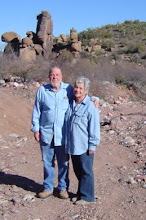
Larry, Jean, Ralph and I decided after yesterday's strenuous jaunt that we'd take today a bit easier. We took a backroad overlooking Roosevelt Lake we'd been on one time before shortly after getting the Jeep. The road was in a lot better condition today, some of the washouts from our previous trip had been filled so the road wasn't as scary as I remembered (or we're now more experienced Jeepers and know what our "Old Peep's Jeep" is capable of.) Since it's winter and the leaves are off the trees and the desert grasses are shorter, we were able to see what we'd totally missed before, some ancient Indian ruins. The foundations of their structures could still be seen outlined in rocks. We speculate that since the rocks looked different from what was found locally, many of them had to be hauled to the site by the ancients...quite an accomplishment without the advantage of a Jeep! The dwellings were on a high hillside perch which would have at that time overlooked the Salt River far below (now Roosevelt Lake), a perfect spot to watch for ones' enemies approaching. We checked the area out for about an hour, each of us finding small pottery shards. A nice Jeep trip, nothing too strenuous and a good way to rest our weary bones.  

Saturday, January 27, 2007

Mine, what mine?

1/27/07
Well, if it's there, we can't find it. We made another unsuccessful attempt at finding Journigan Mine today. We did locate Journigan Spring, but if there's a mine nearby, we sure didn't find it. We went as far as we feel is humanly possible without even a sign that the area had ever been mined. We did pass an area where someone had evidentially looked for gold at one time from the looks of the quartz pile we found, but Journigan was supposed to be a lead mine. The terrain is really rough, mountainous with slippery rock and loads of cacti and prickly bushes. There are no trails, no paths, nothing but the wild Arizona scenery. Larry went one way, Ralph went another, still no luck. Jean and I manned...errr womanned the radios. Dang it, I hate to give up but for now I suppose we'll have to admit defeat....Nah on second thought, we'll keep trying 'til we find it. We KNOW it's there. Ahhh to be young and energetic again.


Monday, January 22, 2007

Desert snow and critters

1/22/07
It snowed here over the weekend. We didn't do any Jeeping instead, stayed by the fire and sipped hot chocolate and watched the snow come down from the snug comfort of home.
Today we decided to ride around a bit and take a few pictures before the snow was all gone. It turned out to be a good ride, great timing because first we came upon a pair of Javelinas (wild pigs). Since they're rather elusive, we felt fortunate to be able to snap a quick picture before they vanished into the underbrush. Riding further, we saw four beautiful deer. Two mothers and two yearlings. We stared at them and they stared at us for several minutes. It was probably a learning opportunity for the yearlings. We could imagine their mothers telling them, "THOSE are the humans we've been telling you about. They'll eat you and then mount your head on a wall...stay away from them!"
The ever-changing desert scenery is so beautiful, we feel fortunate to be able to live here.

Thursday, January 18, 2007

Camp Reno and Sutter's Store

1/18/07
Camp Reno was established by the 1st Cavalry in 1867 and abandoned in 1870. It was an outpost of Fort McDowell and was intended to establish a military presence in Tonto Basin and surrounding areas due to the problems settlers and ranchers were having with regular raids by the Apaches. The actual orders from General McDowell to the 1st Cavalry Captain simply stated,
"You will order that, in making these shelters, the commanding officer shall put them up in the order of time prescribed in General Orders No. 39, for the huts to be built at the camp to be established northeast from Fort McDowell, (Camp Reno). The same provisions as to extra pay to the enlisted men, therein made, will apply in the case of the new camp. I have not authorized more permanent quarters than those which the men could make by their own labor, with the materials at hand, because it was not known, nor could it be ascertained at once where permanent posts would be required. The population in this country is so fluctuating (on account of the uncertainty of mining operations), that it frequently happens that before a permanent post is finished the necessity for it has ceased."
Since the Camp was only operational for three years, one would assume that the "necessity for it had ceased" however, it is speculated that because of the remoteness of the camp, the high cost of supplying the camp was more likely the reason for its demise. The 1st Cavalry proved to be effective in curtailing the murderous raids during the three years they were encamped on a mesa at the foot of what is now Reno Pass.
Forest Service maps indicate Camp Reno being located at the foot of the mesa, but in actuality, that is not the correct location. The location marked by a sign is actually the location of Sutter's Store, a general store which was built by locals to supply the needs of the camp and surrounding settlers. Not much remains today of either Camp Reno or Sutter's Store. The area the store was in contains just a few concrete slabs and a spring. The remains of the camp are a bit harder to spot because they aren't marked but you can still see the stones in place outlining the places where the 1st Cavalry had their tents erected.
We hiked the area yesterday and found an old cemetery in the foothills. The entire area was severely damaged by wildfires a few years ago. Although there's not much to see, it's still fun to visit the area and speculate on what it must have been like.

Cemetery near Camp Reno
Name:  Camp Reno Cemetery 003.jpg
Views: 1
Size:  58.7 KB
Name:  Camp Reno Cemetery 002.jpg
Views: 1
Size:  61.5 KB
This wall was probably used to protect against Apache attacks
Name:  Camp Reno Cemetery 009.jpg
Views: 1
Size:  40.7 KB
In actuality, this is not Camp Reno but instead is the site of Sutter's General Store
Name:  Camp Reno Cemetery 011.jpg
Views: 1
Size:  48.4 KB
The spring at Sutter's Store
Name:  Camp Reno Cemetery 017.jpg
Views: 1
Size:  57.7 KB

Sunday, January 14, 2007

Jack Shoe Ranch

11/12/07
We set out a bit late today with our friends Larry & Jean with the intent of trying a road marked as a "Jeep Trail" on the map...uh huh...can't trust those maps. The road started out fairly good, passing Jack Shoe Ranch, some rocks to traverse, some ditches to cross, just the kind of thing a Jeep was designed to do. Then as we progressed, we could see a canyon ahead, as we drove on further, the "Jeep Trail" quickly became something more designed for a Mountain Goat. The trail headed along the edge of a very deep canyon and became tippy, off camber, and downright scary....so...since Jean and I were protesting loudly, it was decided to cut the trip short and turn around ...whew...that's a sigh of relief. After some stealthy maneuvering, Larry and Ralph got the Jeeps turned around (try turning around on the edge of a canyon sometime...yikes)! and we headed back from whence we came.
We stopped at Jack Shoe Ranch to catch our breath and while Larry and Ralph were chatting about the Jeeps, Jean and I decided to crawl under the locked gate leading to Jack Shoe Ranch and go take a look around. What a neat place! Not much can be found about its history, we've heard that it was connected with Sunset Mine, it's located at the base of the mountain that Sunset Mine is located on.  (see earlier post on Sunset Mine) and now it's apparently used only as an occasional weekend retreat by the fortunate owners. Jack Shoe looks like something cut from the pages of history of the old west. There's a bunkhouse, small ranch house, several outbuildings and a general feeling of a once busy working ranch. It's located on the edge of a steep canyon with the canyon walls rising behind the ranch like a huge stone sentry. You can imagine the inhabitants felt reasonably secure from surprise Indian attacks, only having to guard the entry road because the natural terrain would protect them from sneak attacks. Peering through the windows was like looking back in time, the inside was furnished by period pieces, old iron beds, antique cabinets and wood burning stoves. I can imagine the lady of the house ringing the dinner bell on the front porch calling the ranch hands and miners to feast on homemade bread and beans. Scattered here and there throughout the property were saddles, ropes, branding irons and steer skulls.
We can only speculate on the hardships these people endured, but it's nice to take the time to ponder it all.  

Wednesday, January 10, 2007

Gold Prospecting

1/10/07

This morning we tried our hand at a real Arizona pastime, gold prospecting. We Jeeped over to Quartz Ledge Mine, once a fairly successful gold mine located near the western end of Roosevelt Lake and spent the day digging in the dry riverbed below the mine. We didn't find any nuggets, but we did see gold flecks in some of the sand. It's a relaxing way to spend the day particularly in nice weather. We'll go back and dig some more...wish us luck!
These are pictures of what's left of Quartz Ledge Mine, you can still see the ore cart tracks leading out of the mine.
 

Tuesday, January 9, 2007

Still Trekking

1/9/07
Whew...Yesterday we tried again. Another attempt at finding Journigan Mine. This time we believe we came closer to finding it by following an old water line which had been run from the Journigan Springs to some cattle water tanks down at lower levels. Our topographical maps locate the mine nearby the spring, so if that's the case, we're not far off. It was a great hike, but we're paying for it today with a few aching muscles...this too shall pass. A beautiful pair of Red-Tail Hawks kept us company during our hike, perching on nearby Saguaros and whistling to us as we trekked up the steep wash. We even paused for brief time to dig around in the sandy wash looking for gold nuggets. We did see some yellow flakes, not sure if they were gold, but they sure looked like it. Needless to say, we'll be heading back in search of the Journigan Mine. One thing is for sure, when we do find it, because of its remote location, we probably won't find too much evidence of modern man.

Friday, January 5, 2007

Journey To Journigan

1/05/07
 
Another Attempt To Find Journigan Mine
 
Yesterday we made another attempt to locate a mine we've researched but haven't been able to locate. We know the proximity and have located it on some of our topographical maps, but even though we can see it on the map, once you're Jeeping around and hiking the rough terrain, it's not always so apparent. We followed the Jeep trail as far as we could until the trail became too rough to maneuver in our Jeep, so we parked and decided to hike up a dry gulch as far as we could. We did see what we believe to be a claim marker on top of a hill, but it might not be related to the Journigan. Journigan Mine hasn't been operational since the early 1900s and this marker looked to be much newer.
Anyhoo, Ralph decided to get to the highest point around to see if he could locate anything with our binoculars, I remained behind on a rocky perch and watched his progress as he made his way up the rocky climb. Reaching the top of the mountain offered him a bird's eye view of the area, but still no luck. It was a beautiful day for hiking, so all wasn't lost, the scenery alone would have been worthwhile to see.
We'll go back again and make another attempt to find the mine, there are still some areas we haven't explored and we're determined. I suppose if these remote sites were easier to reach, everyone would be reaching them. Part of the thrill of exploration is to go to places where people haven't been in many, many years.


Monday, January 1, 2007

The Former town of Livingston, Arizona

1/01/07
We spent a couple of days exploring the area of the former town of Livingston, AZ once located at what is now the SE end of Roosevelt Lake. Livingston although in existence earlier, got a post office in 1896 but it closed in 1907 when it became apparent that the town would cease to exist once Roosevelt Dam was completed and the flooding to form Roosevelt Lake took place. There are no structural remains, except for vague outlines of buildings and some piles of timbers. The only remnants we found were done by metal detecting the area. When the level of Roosevelt Lake rises, the area the town once occupied disappears under the water. Livingston consisted of a small general store/post office, several ranches and some homes. The area is closed to all motorized vehicle traffic because there's some endangered bird supposedly ground nesting in the area.....wonder where the bird goes when the lake level rises?

These remains were all we were able to find metal detecting
Name:  Livingston 007.jpg
Views: 1
Size:  64.7 KB
Not much left of the town of Livingston, Arizona
Name:  Livingston 010.jpg
Views: 1
Size:  42.3 KB

Name:  Livingston 011.jpg
Views: 1
Size:  46.3 KB
This is where Livingston once stood. When Roosevelt Lake's waters rise, this area is under water.
Name:  A-Cross Gypsum, Livingston, Four peaks 002.jpg
Views: 0
Size:  45.9 KB