Sunday, October 22, 2006

Four Peaks

10/22/06
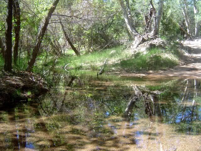
This morning we slept a bit later than usual because we stayed up last night to view the Orionid Meteor Shower, it was a good viewing night, clear sky, zillions of stars and a stiff neck afterward from gazing skyward.
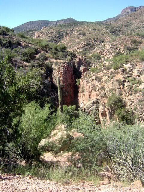
Anyway, we decided we'd go for a short jaunt so we headed for a short route we'd passed on a previous trip. The road was pretty good by Jeeping standards, with just a few minor washouts and a couple of undercarriage scraping boulders in the roadway. We began our ride on FR 429, an uphill climb overlooking Roosevelt Lake to the north and Four Peaks to the west, from there we took a plateau road FR 336 heading east toward the Superstition Wilderness. 
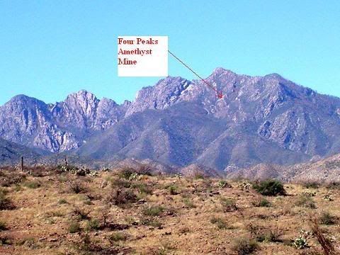
Four Peaks (elevation 7657 Feet) is an Arizona Landmark which can be seen for many miles away, located within the Four Peaks Wilderness and not accessible to motorized vehicles. It's the home of Four Peaks Amethyst Mine, a very old mine once worked by the Spaniards who explored Arizona in the 1500s. The gems found in this extremely isolated location were of such excellent quality that they were sent to Spain where they became part of the Spanish crown jewels. The mine itself is privately owned and mined only on an occasional basis because access by helicopter or hiking makes full time operations impractical.
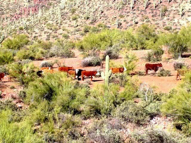
We'll probably be heading back to FR 336, the temperatures were rising this afternoon so we decided not to do any hiking.  Through our binoculars we could see some interesting remains of what looked like an old placer gold mining location. I know we'll go back to check it out!
 
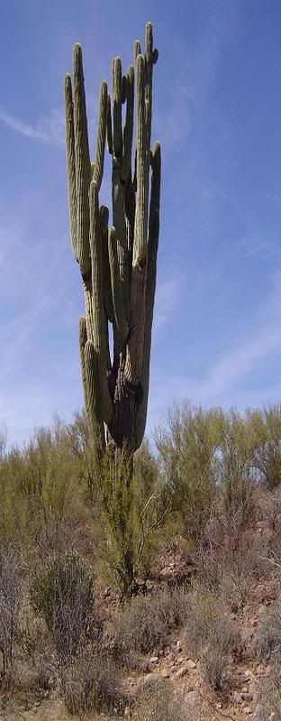
This is a view of Four Peaks taken from FR 429. It's quite an imposing sight to see soaring above the desert floor. I can't imagine mining at that altitude and on a mountainside to boot!
 
locatingthemine.jpg

This is an Amethyst from Four Peaks Mine
 
Amethyst2.jpg 


Saturday, October 14, 2006

Bouquet Ranch, a desert oasis

Bouquet Ranch   July 11, 2006
This is a photo taken at what used to be The Bouquet Ranch. It was named for Charles Bouquet who homesteaded the place in the late 1800's. It's located east of Tonto Creek in Arizona. (In the Tonto National Forest near Punkin Center) He didn't ranch cattle or sheep like most early ranchers did, instead, he grew fruit. Oranges, lemons, apples, peaches and pears, many of the trees he had shipped from France. Imagine keeping young trees alive on a ship and then on a trip by wagon through the desert. His original intent when he emigrated to the USA from France was to raise cattle, but he found he had a bountiful natural spring on his property, a rare commodity in these parts. Since he'd worked in his father's orchards in France, he figured he'd be better off doing something that he knew instead of trying to raise livestock.
Not much is left of the old ranch today except for a few timbers and some stones, unfortunately, it's been bulldozed. It sits on private property within the National Forest. The one thing that remains is the beautiful, shady oasis, the Bouquet spring. There are about 10 enormous palm trees Charles Bouquet planted at the water's edge with their roots in the water. They're flourishing today. It's hard to imagine such a place exists in the Arizona desert, especially on a 110 degree day like today.
When we were there, it was full of bullfrogs and water birds, taking refuge beneath the palm tree's heavy skirts. What a site!


Thursday, October 5, 2006

The Apache Trail

SunsetArizona.jpg


                                                               ApacheTrailEarlyMorning003.jpg


RooseveltDamShot.jpg


                                      The Apache Trail

Lore and legend cloak canyon walls with an air of mystery

Sheer cliffs of stark grandeur careen toward peacefulrivers

 Silent breezes are accented by cries from soaring hawks

We envy their freedom to view this world from a unique vantage

 Boulders balanced upon tenuous perches as though placed there by playful hands

Spires and minarets of sandstone by no accident call to mind holy places

Lakes of unfathomed depth keep secret the hidden vista below

 Each mile is given to us as a gift revealed as we venture on

Dizzying heights give way to peaceful meadows, our senses are assailed by what unfolds before us

Layers of time are seen in ageless formations

Cactus basks beneath the broiling sun luxuriating in the nourishing heat

Storm clouds sneak in unnoticed by enthralled travelers

 The sky darkens to rich gray hues, a deep growl of thunder echoes followed by unleashed streaks of lightening splitting the boiling clouds

The hawk dives for cover sensing what is to come

Monsoon rains fall fast and hard upon the arid landscape

The sand drinks 'til sated then rejects the leftovers filling once dry washes and gulches as waters stampede to lower points

 Rocks with eons old addresses move with the torrential onslaught seeking relocation

As quickly as the storm enters, it vanishes as the clouds are tossed aside by the jealous sun, eager to retake his domain

The hawk shakes and preens droplets from his feathers, then leaps joyously forth to survey the changes

Catching a current, he ascends smoothly, dipping and gliding his dance beneath the sun

Reaching a rise, we pause to survey the panoramic wonder spread before us

Our eyes try to reject the reality of such contradiction

Green, brown, blue and purple assault our senses in a riotous ballet of colors

Moving on, we see scorched ground which bespeaks a bygone day when hellish blazes charred the already arid earth

Tiny shoots of infant cacti pierce the sand refusing to concede defeat

Weary and dusty we come upon man's imposition on the land

 Rising from the depth of a canyon, steel and concrete seems alien in these surroundings, daring to ration water to the valleys below.

Exhilaration is felt as we reach trails end, yet the lore and legend beckons our return

Our spirits are lifted, our souls have been nourished

©1999-2007 Laura Aden

Special thanks to the Tonto National Forest Rangers (Roosevelt Lake)

10/5/06

We would be remiss if we didn't take this opportunity to thank the fine people at the Tonto National Forest Ranger Station. In particular, Forest Ranger,Quinton Johnson who has answered numerous questions and told us some wonderful places to seek out. He knows the TNF like the back of his hand and is more than willing to share his knowledge.

We're lucky to live just minutes away from the Roosevelt Lake Visitor Center which is also home base for our local Ranger Station.

Thanks so much!

This is Quinton Johnson, Ranger Extraordinaire!

QuintonJohnsonTNF001.jpg

Visitor Center and Ranger Station at Roosevelt Lake 
QuintonJohnsonTNF002.jpg


Desert beauty

Many people who haven't visited Arizona really have the wrong impression of what it's really like. Picturing Sahara type sand dunes, a stark environment and camels is quite different than it really is.  Of course summer temperatures are not fit for man nor beast, but that's why air conditioning was invented. The rest of the year we've got a moderate climate making Arizona a wonderful place to be. We get ample rains most years to keep the desert green and thriving with an array of fabulous desert plants. Below you'll see pictures of some of the more common ones in our area. There are quite a few more, but I'll have to post them at another time after we get some good shots.
Hope you enjoy our desert flora!
 
This is one of my favorites, a Palo Verde Tree (Spanish for "green stick") a lovely tree that bears pretty yellow flowers. The bark and branches are a lime green color, very nice!

PaloVerde.jpg

 
This is the Teddy Bear Cholla, it sounds soft and cuddly
It's NOT!

JumpingCholla.jpg

This is a Hedgehog Cactus and Daisies in bloom beneath a Cholla.
BloomingHedgehog.jpg

Jumping Cholla Cacti, this is one of the desert's bad boys. (no they don't really jump but if you pass close to one, you're almost guaranteed to get stuck!) The spines fall on the ground and if stepped on, they can puncture even a heavy hiking boot.

JumpingCholla-1.jpg

 
The symbol of the desert. The mighty Saguaro. These giants can live to be several hundred years old. They're masters at storing water within their pleated skins which expand as water increases. They provide shelter to a variety of desert dwelling birds and critters.

MightySaguaro.jpg


 The Ocotillo looks like a cactus but really isn't, it's got leaves and cacti don't have leaves. It blooms in the springtime bearing pretty red flowers on the ends of each stem. Early ranchers often planted these instead of using barbed wire because the spiny stems would keep cattle contained within the confines of the living corral.

Ocotillo.jpg

This is our giant Prickly Pear growing alongside our house. The blooms look like something right out of a Georgia O'Keeffe painting.

GiantPricklyPearYellow.jpg

The same cactus decided to put out orange flowers instead of yellow 
GiantPrickyPearBlooming.jpg

This is another variety of Prickly Pear growing wild. In the colder months they turn from green to purple.  Javelina (the southwest version of a wild pig) love the Prickly Pears, they eat them spines and all...ouch!
ACrossRoad013.jpg


A Hummingbird Moth who came to visit our window box

HummingbirdMoth003.jpg  


Wednesday, October 4, 2006

Reavis Ranch, Campaign Trailhead

9/18/06
We packed up a couple of ham sandwiches and cold drinks and headed out at first light for parts unknown. We're going back over trails nearest our home because the first time we ran them, we were still unfamiliar with the Jeep and really not paying close attention to our surroundings.
We wound up on FR 449 Campaign Trail, heading for the Reavis Ranch Trailhead. Reavis Ranch was once the home of Elisha Reavis, (born 1827 died 1898) also known as "The Hermit of the Superstitions."
He was an interesting character to say the least. He was a well educated man and at one time he taught school in California and married. He gave it all up to pursue the lust for gold that was the fashion of the time in the desert southwest. People still speculate as to whether ever found the gold at the end of his rainbow. When his estate was probated in Phoenix, no gold was reported, but it was very much the style of that period to bury found gold in secret locations. After wandering the hills and deserts, he finally settled in the Superstition Mountains and homesteaded a ranch high up in the mountains where he grew apples and other fruit. His body was found alongside the trail near his orchards. He was buried where he was found, alongside his beloved long time companion, his mule. To this day it is said that he and his mule, can be seen still walking the canyons near his ranch. The beautiful, mysterious, Superstition Wilderness abounds with such ghostly tales.
 
Elisha Reavis 1827-1898
"The Hermit of The Superstitions"

x95tmp.jpg

 
Haunted Chasm, The ghosts of Elisha Reavis and his mule are said to wander these canyons and mountains....searching.....
HauntedReavisChasm.jpg

The Crossing at Campaign Creek 
CampaignCreekCrossing.jpg


It's not an unusal sight to see windmills and water tanks in the back country. They pump water for free range cattle from cool underground springs.  


RidetoCampaignTrailheadReevis009.jpg

 
This is one of the many corrals found scattered around the back country.
 
RidetoCampaignTrailheadReevis011.jpg

 Here's a small herd of free range cattle. They have the right of way on all backroads!

MoocowsA-cross001.jpg


Tuesday, October 3, 2006

Our "Old Peep's Jeep"


This little treasure was a Christmas gift to each other.  It has entirely changed our retirement. When we decided it was time to spend more time together and eliminate the job stresses we moved from California to our "fixer-upper" in beautiful Roosevelt, Arizona. We thought we'd probably spend a lot of our time fixing up our home, reading and doing the kinds of things we imagined retirees were supposed to do....WRONG! After getting our humble abode in livable, cozy condition, we found we were looking for more fulfillment to stimulate our all- too-quickly-aging brains, so we went looking for a pickup truck that would both fill the need to haul junk around and also take us places that our little Toyota couldn't.

Well, we saw our little red Jeep sitting on a hillside at a dealership lot ... it was love at first sight.  The rest as they say, is history. Although it's not much in the way of hauling large stuff around, it hauls us just fine. We christened it "Old Peep's Jeep". We're now able to go places we never dreamed of going before and certainly places that most folks don't ever get to see in an "ordinary" vehicle. Now, we spend almost every day during the cooler months (September to June if the temperatures hold) exploring abandoned mining sites, ghost towns or just experiencing all that Arizona has to offer in the way of scenic beauty.

When the temperatures begin to climb to the upper 90s and 100s, we throw out the anchor and spend time indoors, researching online the places we've discovered and reading every available book we can find on these fantastic pieces of Arizona's history.  Life is good, the rocking chairs will have to wait, we're not ready for them yet!

                                                     Name:  rockingchair2.gif
Views: 12
Size:  5.2 KB    Name:  rockingchair2.gif
Views: 12
Size:  5.2 KB


Sunday, October 1, 2006

Quartz Ledge Mine, the return

9/27/06
Following a mining map from The Arizona Department of Mines & Minerals we found a mine named Quartz Ledge Mine. It was evidentially in operation in recent years (1971-1973) We read that a "reasonable" amount of gold was found, but nobody seemed to know how much or what the circumstances were. The area is loaded with large white quartz outcroppings and from information we found online about the mine, it was a "Shear Zone" mine, meaning there were veins of gold found amid the quartz. There was a lot of dirt and quartz piled all over the ground, tailings from the mining. We didn't climb down any further into the canyon to see if there was an actual mine adit. Next time we head back there, we'll take our metal detector to check out the quartz, a likely place to find gold if there's any left.

 
These are pictures of the quartz outcroppings and piles of tailings scattered all around the area.
Name:  Quartz Ledge Gold Mine 001.jpg
Views: 36
Size:  33.7 KB
Name:  Quartz Ledge Gold Mine 002.jpg
Views: 36
Size:  28.9 KB
Name:  Quartz Ledge Gold Mine 009.jpg
Views: 36
Size:  36.3 KB

A fuzzy critter ...maybe a gold mine security guard!
Name:  Quartz Ledge Gold Mine 005.jpg
Views: 36
Size:  70.7 KB
 
 
Sunday, October 8, 2006
We went back to Quartz Ledge Gold Mine yesterday with friends Jean & Larry for backup. They in their Jeep, us in ours'. It turned out to be a successful excursion because our friend Larry took off hiking with his trusty pooch and found the adit. It was an impressive structure with a well-built stone wall entrance leading to the actual adit. The rails leading from the mine were the heaviest we'd ever seen, leading us to speculate of the size and weight of the oar cars it carried. There were some bent iron ruins scattered about the area. Unfortunately, the mine itself isn't accessible it was either collapsed near the entrance or purposely caved in. If someone really wanted to take the chance, there were still openings amid the rubble but it would be risky to say the least.
We took our metal detector, but it went crazy with signals all over the areas my husband swept, there appears to be a lot of iron ore present, so it wasn't very conducive to good metal detecting. There's probably "gold in them thar hills," but it'll take some real searching to hit it lucky.
 
 
collapsed adit
Name:  collapsed adit.jpg
Views: 3
Size:  42.8 KB

some cement block ruins near the entrance to the mine area
Name:  cement block ruins.jpg
Views: 3
Size:  26.7 KB

Part of the heavy rails
(there were more leading from the mine)

Name:  heavy rails.jpg
Views: 3
Size:  34.3 KB

Iron ruins, we don't know what it was.
Name:  iron ruins.jpg
Views: 3
Size:  34.0 KB
This stone and block wall ran down both sides and then across the entrance leading to the adit
Name:  wall to adit.jpg
Views: 1
Size:  35.8 KB

No clue what this might have been
Name:  no clue iron.jpg
Views: 1
Size:  38.1 KB

This friendly Walking Stick decided to hitch a ride with Jean & Larry
Name:  Walking stick hitch hiker.jpg
Views: 1
Size:  59.9 KB

Return to The Blue Bird

9/25/06

A fellow Ghost Town explorer from Tucson drove up and went with us to make another attempt to reach the still elusive Blue Bird Mine. We got within sight of it, even explored one of the adits, but to reach the actual mining area where the buildings are located it'll take a pretty good hike up a dry river wash to get there. We decided to wait until the temps turned cold and Rattle Snakes were all bedded down for the winter before hiking the wash. Now that it's within sight, it's even more tantalizing than before because we know there's going to be a lot to explore.

Ralph & Laura outside one of the Blue Bird's adits. (Yep, there's old bats in that mine)


   Shot through a zoom lens, one of the buildings at the Blue Bird


This is the Bluebird ore shute seen in the distance. It's a big one! There are a few structures to the right of the shute that can't be seen in the photo
Name:  Ore Shute.jpg
Views: 42
Size:  39.5 KB

This is a shot of fellow Ghost Towner, Brian taken from one of the Bluebird's adits
Name:  Brian as seen from Bluebird's adit.jpg
Views: 40
Size:  44.7 KB

A few repairs at Brian and Ralph's Trail Garage on Brian's Samurai
Name:  Ralph & Brian's trail garage.jpg
Views: 40
Size:  30.5 KB
 
Yep, it's humble me...err I
overlooking Tonto Basin not far from the Bluebird
Name:  Laura overlooking Tonto Basin.jpg
Views: 40
Size:  33.2 KB

We got our wings! Asbestos Point

9/30/06
We did it...We got our wings today! Finally we were able to reach the top of Asbestos Point, better known locally as "Angel Wings". What a fabulous place! The views were not for the faint of heart, (elevation 6,662 feet) neither was the tippy, rocky road leading up to the top. It's about a three mile Jeep climb to the top of the mountain from Route 288 above Roosevelt through cool shady pine forests. Our new neighbors, who had been there before were kind enough to lead the way in their Jeep. Thanks Larry & Jean!
There are several adits, most in pretty good condition and had it not been snake season, we probably would have ventured inside at least one of them. Standing at one of the entrances we could feel the cool air coming from inside the labyrinth.
Asbestos in its raw form is a beautiful mineral, it glistens in the sunlight, Mother Nature sure knows how to create a jewel. There weren't any structures left standing, mostly collapsed unidentifiable ruins, although we understand there are several more structures scattered around in the surrounding woods. Now when we look up at Angel Wings from our home in Roosevelt, we can say we've been there. These pictures are mostly scenic, but you can get an idea what kind of operation it was and the daily risks these miners took to get the job done. (you sure didn't step back very far to admire your work) They must have been some very hardy folks.
                                             
View of Asbestos Mine taken from Hwy 288. "Angel Wings"
Name:  Angel Wings smaller.JPG
Views: 93
Size:  15.5 KB

The remains of a crane
Roosevelt Lake can be seen in the upper right
Name:  Crane remains.jpg
Views: 11
Size:  41.4 KB

Asbestos Adit
Name:  Asbestos Adit.jpg
Views: 11
Size:  40.6 KB

This adit had several tunnels leading off into different directions
Name:  Huge adit with more tunnels.jpg
Views: 11
Size:  37.3 KB

This is one of the "Angel Wings" shown in previous a picture as  seen from the top
Name:  Right Wing.jpg
Views: 11
Size:  55.5 KB
View from the top
Name:  What a view.jpg
Views: 11
Size:  43.1 KB
Evidentially there was also a WPA fish hatchery in this area, this stocking shack and some stone pools are all that remains
Name:  Fish Hatchery Shack.jpg
Views: 11
Size:  74.3 KB
More view from the top. That's Roosevelt Lake seen in the distance. We live on the far left side of the lake.
Name:  More View.jpg
Views: 8
Size:  40.2 KB
Some sample mining done in the area
Name:  Sample mining.jpg
Views: 9
Size:  57.1 KB