9/30/06
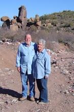
We did it...We got our wings today! Finally we were able to reach the top of Asbestos Point, better known locally as "Angel Wings". What a fabulous place! The views were not for the faint of heart, (elevation 6,662 feet) neither was the tippy, rocky road leading up to the top. It's about a three mile Jeep climb to the top of the mountain from Route 288 above Roosevelt through cool shady pine forests. Our new neighbors, who had been there before were kind enough to lead the way in their Jeep. Thanks Larry & Jean!
There are several adits, most in pretty good condition and had it not been snake season, we probably would have ventured inside at least one of them. Standing at one of the entrances we could feel the cool air coming from inside the labyrinth.
Asbestos in its raw form is a beautiful mineral, it glistens in the sunlight, Mother Nature sure knows how to create a jewel. There weren't any structures left standing, mostly collapsed unidentifiable ruins, although we understand there are several more structures scattered around in the surrounding woods. Now when we look up at Angel Wings from our home in Roosevelt, we can say we've been there. These pictures are mostly scenic, but you can get an idea what kind of operation it was and the daily risks these miners took to get the job done. (you sure didn't step back very far to admire your work) They must have been some very hardy folks.
View of Asbestos Mine taken from Hwy 288. "Angel Wings"

The remains of a crane
Roosevelt Lake can be seen in the upper right

Roosevelt Lake can be seen in the upper right
Asbestos Adit

This adit had several tunnels leading off into different directions

This is one of the "Angel Wings" shown in previous a picture as seen from the top

View from the top

Evidentially there was also a WPA fish hatchery in this area, this stocking shack and some stone pools are all that remains

More view from the top. That's Roosevelt Lake seen in the distance. We live on the far left side of the lake.

Some sample mining done in the area

Evidentially there was also a WPA fish hatchery in this area, this stocking shack and some stone pools are all that remains
More view from the top. That's Roosevelt Lake seen in the distance. We live on the far left side of the lake.
Some sample mining done in the area