Saturday, February 20, 2010

I Told You So!

We've had some really fantastic weather all week long, sunny, mild...simply perfect so we decided to head out on a Jeep run on FR609. It's a fairly long run up in the mountains, one of our favorites. Larry and Jean and a couple of friends from Tucson wanted to go along too on what should have been a pleasant drive up through the pines and pastures, stopping along the way to visit a cave we wanted to explore again. All week long the weather people have been reporting that rains were expected beginning Saturday and continuing on and off throughout the weekend. Heck, what do they know?
We awoke this morning to spotty clouds, but the worse part were the mountains, we couldn't even see them in the distance, they were completely covered in clouds. I muttered something about it being a damned fool idea to head up there in bad weather, but my objections were met with, "nah, it looks okay to me," so off we went. Crossing Tonto Creek can be a bit of a challenge, but after ignoring the rather large barricade and sign declaring "road closed" we made it across the flooded creek without a problem. The clouds were getting thicker, darker and more threatening as we headed up the mountain. Rain was beginning to spatter on the windshield, mud was getting deeper, so deep that we all decided to stop and let some air out of our tires to give them more traction getting through the mud. We were fairly high up in the clouds by this time, the fog was closing in along with the heavy sleet that was pelting us and covering the muddy road in white pellets. The Jeeps were sliding, fishtailing, making the drive pretty treacherous and we knew that the road ahead wouldn't be any better so deciding discretion is indeed the better part of valor, we turned back. I've got to admit feeling rather smug on the ride back home but I held it in as long as I could before I blurted out, "I told you so!" .... only to be met with a distinct "harumph" from Ralph.
Oh well, better luck next time.
***

Tonto Creek crossing, "road closed" (what road?)

Foggy and rainy, mud soup

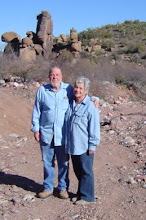
"view" of the mountains?
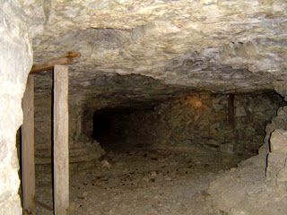

The forest primeval


Sliding through the mud


Saturday, January 23, 2010

Redefining The Desert

Webster's says;
Main Entry: desert
Pronunciation: de-z-rt
Function: noun
Results
1. arid land with usually sparse vegetation especially such land having a very warm climate and receiving less than 25 centimeters (10 inches) of sporadic rainfall annually.
b. an area of water apparently devoid of life
2. wild uninhabited and uncultivated tract
3. desolate or forbidding area

Holy smoke! We've had about five straight days of steady rain here, it sure doesn't fit the definition of "desert" we find in the dictionary.
Gila County Sheriff's deputies were going door to door out here, warning people that evacuation might be eminent due to the potential of heavy flooding in our area. It was a wild week, the rain didn't stop except for a brief time yesterday when the sun broke through just long enough to show us that it was still up there where it belongs. We were lucky to escape relatively unscathed, happily evacuation wasn't necessary, although we did have the Jeep loaded with things we might need to survive a few days away from home. There were times we did get a bit nervous, particularly when the "dry" wash behind our house began to flow like a small river, we've never seen water in it before. Pinto Creek, the larger wash near us is roaring along the way to the lake along with every other formerly dry wash and riverbed in the area.
We've had more rain in five days than Arizona normally gets in an entire year. The mountains have gotten record breaking snows in some areas and even some ski resorts are closed because there's too much snow!
Growlph, our picky little Schnauzer has to be forced to go outside, he despises getting his paws wet, the poor little guy prefers to hold his business rather than risk getting wet. He's been wet and dry so many times, we're sure he's going to mildew if the rain doesn't stop soon. Ah, there's nothing quite like the essence of a wet dog. (Eau de Schnauzer?)
Our electricity was out for a few hours on and off during the week and yesterday, we had no phone service outside of our small calling area..no internet...Egads! We managed to stay snug, dry and warm in front of our wood stove so all in all, we have no real complaints.
Many major roads are closed for various weather related reasons including some interstate highways in the northern part of the state. The Forest Service has closed quite a few back roads due to unsafe conditions. Anyhoo, it looks like our Jeeping may be put on hold at least for a while until the trails have dried out a bit.
The entire state has had its share of something, flooding, dust storms, hail, sleet, freezing rain, wind, blizzards, snow.... we can't help but wonder what's coming next...locusts? pestilence? famine?
****
Here are some pictures we took this morning between the raindrops, it sure doesn't look deserty to us!


Friday, January 15, 2010

The Ray Mine

It's a beautiful day today, clear, cool and sunny. We decided to take a ride to an area we've passed before but never had driven through. It's a big circular route leaving from Globe and heading down to Superior and then across to Winkleman and back up to Globe. It's all paved highway, no backroading today.... about 90+ miles or so.
We've read about the Ray Mine being the second largest open pit copper mine in the state and wanted to see it first hand. Wow, what a gruesomely awesome sight it is! Huge doesn't begin to describe it, the photos can't show the true enormity and scope of the operation. Although we don't consider ourselves to be "tree huggers" or extreme environmentalists, we can't help but ponder what impact such an undertaking has on the environment, even the signs at the scenic overlook at the mine tell about sulfuric acid being used in the processing of copper ore. We watched as giant dump trucks crept back and forth dumping load afer load of mine tailings, leaving concentric mountains in place of the ones Mother Nature had previously put there. Yep, the world needs copper, lots of it and it's got to be mined somewhere...but.......sigh

The little dots in the center of this photo are giant dump trucks


A huge shovel and a $20,000 truck tire. (so the sign said) and a frustrated Schnauzer who wanted to piddle on the truck tire but couldn't because it was fenced off.


Mother Nature didn't intend for mountains to look like these


Thousands of feet deep into the open pit


Lots of copper is being hauled from this site


Sunday, January 10, 2010

Jeeping The Pinal Mountains

Great Day! Yesterday we went Jeeping with some good folks from the Casa Grande 4-Wheelers Club, Bruce & Judy, Bill & Maureen, Russ & Jackie, as well as a cheerful Border Collie named Socks.

We headed out with no particular destination in mind except to explore some of the areas in the Pinal Mountains, south of the town of Globe. The Pinals offer a range of vastly differing scenery ranging from lush pine and Manazanita forests to desert plateaus thick with barrel cacti, creosote bushes and scrub. Altitudes were mostly high, some close to 8000 feet, offering gorgeous, sweeping views of the mountains surrounding us.

The roads were fairly good with the very notable exception of the trail leading from Pioneer Basin up to Pioneer Pass. We've always been told that this trail in particular could be a problem, especially in bad weather. Fortunately, the day was clear and sunny and the trail was dry. After taking a long, bumpy trail we came upon a house and an old mining camp. The lone resident, a "different" fellow, a true hermit lived there with only the company of his dog, many miles away from the nearest civilization. Bruce stopped to chat with him and ask about the road conditions ahead. I don't know what was said but just past his place the trail turned ugly. We had to make the choice of attempting it or turning back from whence we came. We decided to attempt it. Since we drive a mostly "stock" Jeep while the other three are built more for this kind of terrain, we were a bit concerned about whether we could make it through without any carnage to our Jeep, but our worries proved to be unfounded. Ralph's Jeep driving experience served him well, we made it through with only a relatively few groans, stiffled screams and gasps from me....good job Ralph!

It was nice meeting new people and making new friends with the same interests as ours'...to enjoy the scenic beauty the backroads of Arizona has to offer to fellow Jeepers.

Ready to hit the trail


There's the road far below


Sweeping views of the Pinals


Howdy folks!


Challenging to( say the least)


NOT a road well traveled!


Pioneer Basin


We were rewarded with this spectacular view

Sunday, December 20, 2009

Jeepin' to McMillenville

We decided to head for the former town of McMillenville yesterday. Back in the 1800s McMillenville was a fairly large silver mining town, it even had a post office, established in November, 1877 until October, 1882. Nowadays, not much remains of its former glory.
During the town's heyday it was subjected to a major, brutal Apache raid. It seems that the area was once part of land designated by the government to be part of the Apache reservation. Then, silver was discovered there by a pair of wandering prospectors, Charlie McMillen and Theodore Harris, March 6, 1876. It wasn't long after that the government decided to "resurvey" the reservation, low and behold the government determined that the land containing the rich silver strike wasn't part of the reservation afterall... hmmm mighty suspicious, (seems typical of government activity but that thought is for another post and probably not appropriate here...okay Laura, step away from that soapbox!) anyway, it's a small wonder the Apaches were angry.
In
Nell Murbarger's wonderful book, "Ghosts Of The Adobe Walls", Nell describes the town as she found it back in 1950. There were still adobe ruins of old miner's cabins present but even then, not much remained of the town. The original main mine, the Stonewall Jackson is now located on private property, the rest of what remains is on Tonto National Forest land.
We found outlines of old buildings, some Indian ruins along with the old tin cans that can usually be found at this kind of site. We even found a shard of Indian pottery laying near an eroded wash.
Although little remains of the ghost town of McMillenville, we stood amid the ruins with Nell Murbarger's words echoing in our ears,
" I left the old town of McMillen to its gray adobe ruins, its small gray lizards....and the gray ghosts of its departed dreams."


barely the outline of an old adobe cabin


a miner's cabin probably stood here

Ralph checking out more ruins

after McMillenville we checked out FR 584, oops the road ends here
The view from FS 584

Thursday, December 10, 2009

Seneca Lake

It's been cold here, lots of rain with more on the way beginning tonight. This morning although it was cloudy the sun was trying to come out so we decided to take a ride to look for the former mining town of McMillenville. There's nothing left of the town, but we're hoping to find where it once stood. It had quite a bit of history in its day, Indian attacks and lots of silver mining. They even had a post office for a couple of years back in the late 1800's. We didn't locate the town, or any of the silver mines so we rode a bit further down the road to Seneca Lake, located on the Apache Reservation. At one time Seneca looked to be a really nice place, a trading post, cabins and a pretty campground, all in a sad state of disrepair now. It's a shame to see everything falling down and being vandalized. The lake is still pretty and supposedly has some good fishing, but since it's on the reservation, the $25 per day fishing permit is a bit pricey for a few bass or trout. Past the lake, we tried another road, it led to the edge of the cliffs overlooking the Salt River Canyon, the pictures can't do the place justice, you've got to see these views to believe them. Spectacular to say the least.
We'll do some more research and see if we can find the exact location of McMillenville and make a return trip to the area, if nothing else, the scenery alone makes the trip worthwhile.


Some of the ruins of Seneca, a shame to see it all
falling down


Seneca Lake


You've got to see these views to believe them!


Salt River Canyon far below


Oh my, that's a longgg way down!

Our voices echoed whenever we spoke here


Friday, November 27, 2009

No Turkey, Just Murder and Asbestos

We left our turkey snug and comfy, sitting in the freezer where it belongs and headed to the ghost town of Mule Hoof Bend with Larry and Jean and both pooches yesterday morning. We've read about it and had been told that it was worth seeing, so we finally decided to go. I have to admit, I was dragging my feet for a year or so on making the trip, I knew the elevations were well over 5000 feet and the views were spectacular. Whenever I hear someone say "Oh, the views are awesome" it gets me nervous because along with those views comes my fear of height issue. Well, this time was worth swallowing my fear because it turned out to be one of the most beautiful places we've been thus far. (Thank you Andy B for the history information, preview pictures and report on the road conditions!)
Mule Hoof Bend a former asbestos mining town is located high above the Salt River Canyon. It's got a rather sordid history because the owner of the mine, Guy Phillips was murdered there. His wife, Ruby Mae was charged with the crime but a jury failed to convict her, much to the chagrin of the sheriff at the time who thought he had a solid case against her. Guy Phillips had made a lot of enemies and when people were asked who they thought had committed the murder, they'd reply, "just open the phone book and stick a pin in any name".... I guess he wasn't a very nice guy. If Ruby did indeed commit the crime, people probably understood her reasons behind it, particularly the jury.
There are quite a few remains of the town including the house where the murder took place and even a small jail located in the basement of one of the buildings. Ordinarily, I believe the forest service would have "reclaimed" the entire town by bulldozing the remains, but in the case of Mule Hoof Bend, the whole place is built out of asbestos, even the stucco walls are asbestos, thus requiring a hazardous waste removal, a very costly proposition. Fortunately for us, there is a lot left to see, including the extensive honeycomb of mines located on a mountaintop above Mule Hoof Bend.
After seeing Mule Hoof Bend we drove further down the road toward Regal Mine, we didn't find the mine itself but we did find more and more ruins of abandoned cabins, houses and cars dotting the landscape.
The weather was as perfect as it could be, we couldn't have custom ordered a better day. We'll return to the area in the near future, there was just too much to see in one day, in the meanwhile, our turkey can wait, we enjoyed our grilled steak dinners and the company of a day spent with good friends a whole lot more.
Yep, we do have a lot to be thankful for....


Salt River Canyon far below


One of the mine tunnels


Inside one of the tunnels, they honeycomb the entire
mountain


Another rustic shack further down the road


Umm could you check my oil? I seem to have a "miss"


abandoned houses at Mule Hoof Bend


This small jail is located in the basement of one
of the buildings.


Buddy and Growlph ignoring each other


The murder house, not exactly house beautiful anymore.


More canyon views


Wow, that's a longgg way down!
The detective novels of the day covered the story

We'll never know who really committed the crime.

Ruby Mae and Guy are both dead and if someone else was involved,

they're not talking.