Wednesday, October 4, 2006

Reavis Ranch, Campaign Trailhead

9/18/06
We packed up a couple of ham sandwiches and cold drinks and headed out at first light for parts unknown. We're going back over trails nearest our home because the first time we ran them, we were still unfamiliar with the Jeep and really not paying close attention to our surroundings.
We wound up on FR 449 Campaign Trail, heading for the Reavis Ranch Trailhead. Reavis Ranch was once the home of Elisha Reavis, (born 1827 died 1898) also known as "The Hermit of the Superstitions."
He was an interesting character to say the least. He was a well educated man and at one time he taught school in California and married. He gave it all up to pursue the lust for gold that was the fashion of the time in the desert southwest. People still speculate as to whether ever found the gold at the end of his rainbow. When his estate was probated in Phoenix, no gold was reported, but it was very much the style of that period to bury found gold in secret locations. After wandering the hills and deserts, he finally settled in the Superstition Mountains and homesteaded a ranch high up in the mountains where he grew apples and other fruit. His body was found alongside the trail near his orchards. He was buried where he was found, alongside his beloved long time companion, his mule. To this day it is said that he and his mule, can be seen still walking the canyons near his ranch. The beautiful, mysterious, Superstition Wilderness abounds with such ghostly tales.
 
Elisha Reavis 1827-1898
"The Hermit of The Superstitions"

x95tmp.jpg

 
Haunted Chasm, The ghosts of Elisha Reavis and his mule are said to wander these canyons and mountains....searching.....
HauntedReavisChasm.jpg

The Crossing at Campaign Creek 
CampaignCreekCrossing.jpg


It's not an unusal sight to see windmills and water tanks in the back country. They pump water for free range cattle from cool underground springs.  


RidetoCampaignTrailheadReevis009.jpg

 
This is one of the many corrals found scattered around the back country.
 
RidetoCampaignTrailheadReevis011.jpg

 Here's a small herd of free range cattle. They have the right of way on all backroads!

MoocowsA-cross001.jpg


Tuesday, October 3, 2006

Our "Old Peep's Jeep"


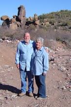
This little treasure was a Christmas gift to each other.  It has entirely changed our retirement. When we decided it was time to spend more time together and eliminate the job stresses we moved from California to our "fixer-upper" in beautiful Roosevelt, Arizona. We thought we'd probably spend a lot of our time fixing up our home, reading and doing the kinds of things we imagined retirees were supposed to do....WRONG! After getting our humble abode in livable, cozy condition, we found we were looking for more fulfillment to stimulate our all- too-quickly-aging brains, so we went looking for a pickup truck that would both fill the need to haul junk around and also take us places that our little Toyota couldn't.

Well, we saw our little red Jeep sitting on a hillside at a dealership lot ... it was love at first sight.  The rest as they say, is history. Although it's not much in the way of hauling large stuff around, it hauls us just fine. We christened it "Old Peep's Jeep". We're now able to go places we never dreamed of going before and certainly places that most folks don't ever get to see in an "ordinary" vehicle. Now, we spend almost every day during the cooler months (September to June if the temperatures hold) exploring abandoned mining sites, ghost towns or just experiencing all that Arizona has to offer in the way of scenic beauty.

When the temperatures begin to climb to the upper 90s and 100s, we throw out the anchor and spend time indoors, researching online the places we've discovered and reading every available book we can find on these fantastic pieces of Arizona's history.  Life is good, the rocking chairs will have to wait, we're not ready for them yet!

                                                     Name:  rockingchair2.gif
Views: 12
Size:  5.2 KB    Name:  rockingchair2.gif
Views: 12
Size:  5.2 KB


Sunday, October 1, 2006

Quartz Ledge Mine, the return

9/27/06
Following a mining map from The Arizona Department of Mines & Minerals we found a mine named Quartz Ledge Mine. It was evidentially in operation in recent years (1971-1973) We read that a "reasonable" amount of gold was found, but nobody seemed to know how much or what the circumstances were. The area is loaded with large white quartz outcroppings and from information we found online about the mine, it was a "Shear Zone" mine, meaning there were veins of gold found amid the quartz. There was a lot of dirt and quartz piled all over the ground, tailings from the mining. We didn't climb down any further into the canyon to see if there was an actual mine adit. Next time we head back there, we'll take our metal detector to check out the quartz, a likely place to find gold if there's any left.

 
These are pictures of the quartz outcroppings and piles of tailings scattered all around the area.
Name:  Quartz Ledge Gold Mine 001.jpg
Views: 36
Size:  33.7 KB
Name:  Quartz Ledge Gold Mine 002.jpg
Views: 36
Size:  28.9 KB
Name:  Quartz Ledge Gold Mine 009.jpg
Views: 36
Size:  36.3 KB

A fuzzy critter ...maybe a gold mine security guard!
Name:  Quartz Ledge Gold Mine 005.jpg
Views: 36
Size:  70.7 KB
 
 
Sunday, October 8, 2006
We went back to Quartz Ledge Gold Mine yesterday with friends Jean & Larry for backup. They in their Jeep, us in ours'. It turned out to be a successful excursion because our friend Larry took off hiking with his trusty pooch and found the adit. It was an impressive structure with a well-built stone wall entrance leading to the actual adit. The rails leading from the mine were the heaviest we'd ever seen, leading us to speculate of the size and weight of the oar cars it carried. There were some bent iron ruins scattered about the area. Unfortunately, the mine itself isn't accessible it was either collapsed near the entrance or purposely caved in. If someone really wanted to take the chance, there were still openings amid the rubble but it would be risky to say the least.
We took our metal detector, but it went crazy with signals all over the areas my husband swept, there appears to be a lot of iron ore present, so it wasn't very conducive to good metal detecting. There's probably "gold in them thar hills," but it'll take some real searching to hit it lucky.
 
 
collapsed adit
Name:  collapsed adit.jpg
Views: 3
Size:  42.8 KB

some cement block ruins near the entrance to the mine area
Name:  cement block ruins.jpg
Views: 3
Size:  26.7 KB

Part of the heavy rails
(there were more leading from the mine)

Name:  heavy rails.jpg
Views: 3
Size:  34.3 KB

Iron ruins, we don't know what it was.
Name:  iron ruins.jpg
Views: 3
Size:  34.0 KB
This stone and block wall ran down both sides and then across the entrance leading to the adit
Name:  wall to adit.jpg
Views: 1
Size:  35.8 KB

No clue what this might have been
Name:  no clue iron.jpg
Views: 1
Size:  38.1 KB

This friendly Walking Stick decided to hitch a ride with Jean & Larry
Name:  Walking stick hitch hiker.jpg
Views: 1
Size:  59.9 KB

Return to The Blue Bird

9/25/06

A fellow Ghost Town explorer from Tucson drove up and went with us to make another attempt to reach the still elusive Blue Bird Mine. We got within sight of it, even explored one of the adits, but to reach the actual mining area where the buildings are located it'll take a pretty good hike up a dry river wash to get there. We decided to wait until the temps turned cold and Rattle Snakes were all bedded down for the winter before hiking the wash. Now that it's within sight, it's even more tantalizing than before because we know there's going to be a lot to explore.

Ralph & Laura outside one of the Blue Bird's adits. (Yep, there's old bats in that mine)


   Shot through a zoom lens, one of the buildings at the Blue Bird


This is the Bluebird ore shute seen in the distance. It's a big one! There are a few structures to the right of the shute that can't be seen in the photo
Name:  Ore Shute.jpg
Views: 42
Size:  39.5 KB

This is a shot of fellow Ghost Towner, Brian taken from one of the Bluebird's adits
Name:  Brian as seen from Bluebird's adit.jpg
Views: 40
Size:  44.7 KB

A few repairs at Brian and Ralph's Trail Garage on Brian's Samurai
Name:  Ralph & Brian's trail garage.jpg
Views: 40
Size:  30.5 KB
 
Yep, it's humble me...err I
overlooking Tonto Basin not far from the Bluebird
Name:  Laura overlooking Tonto Basin.jpg
Views: 40
Size:  33.2 KB

We got our wings! Asbestos Point

9/30/06
We did it...We got our wings today! Finally we were able to reach the top of Asbestos Point, better known locally as "Angel Wings". What a fabulous place! The views were not for the faint of heart, (elevation 6,662 feet) neither was the tippy, rocky road leading up to the top. It's about a three mile Jeep climb to the top of the mountain from Route 288 above Roosevelt through cool shady pine forests. Our new neighbors, who had been there before were kind enough to lead the way in their Jeep. Thanks Larry & Jean!
There are several adits, most in pretty good condition and had it not been snake season, we probably would have ventured inside at least one of them. Standing at one of the entrances we could feel the cool air coming from inside the labyrinth.
Asbestos in its raw form is a beautiful mineral, it glistens in the sunlight, Mother Nature sure knows how to create a jewel. There weren't any structures left standing, mostly collapsed unidentifiable ruins, although we understand there are several more structures scattered around in the surrounding woods. Now when we look up at Angel Wings from our home in Roosevelt, we can say we've been there. These pictures are mostly scenic, but you can get an idea what kind of operation it was and the daily risks these miners took to get the job done. (you sure didn't step back very far to admire your work) They must have been some very hardy folks.
                                             
View of Asbestos Mine taken from Hwy 288. "Angel Wings"
Name:  Angel Wings smaller.JPG
Views: 93
Size:  15.5 KB

The remains of a crane
Roosevelt Lake can be seen in the upper right
Name:  Crane remains.jpg
Views: 11
Size:  41.4 KB

Asbestos Adit
Name:  Asbestos Adit.jpg
Views: 11
Size:  40.6 KB

This adit had several tunnels leading off into different directions
Name:  Huge adit with more tunnels.jpg
Views: 11
Size:  37.3 KB

This is one of the "Angel Wings" shown in previous a picture as  seen from the top
Name:  Right Wing.jpg
Views: 11
Size:  55.5 KB
View from the top
Name:  What a view.jpg
Views: 11
Size:  43.1 KB
Evidentially there was also a WPA fish hatchery in this area, this stocking shack and some stone pools are all that remains
Name:  Fish Hatchery Shack.jpg
Views: 11
Size:  74.3 KB
More view from the top. That's Roosevelt Lake seen in the distance. We live on the far left side of the lake.
Name:  More View.jpg
Views: 8
Size:  40.2 KB
Some sample mining done in the area
Name:  Sample mining.jpg
Views: 9
Size:  57.1 KB

Saturday, September 9, 2006

The Elusive Bluebird Mine

The Elusive Bluebird Mine - September 1, 2006
We got up early this morning and after packing up some sandwiches and cold drinks, we were on the road by 4:30 AM. Driving up to Greenback Valley on FR 71, it was a fabulous trip, cool and beautiful, with dawn just breaking. We'd studied the map and determined there was another road, a backdoor to the Bluebird mining site. The map proved correct, sure enough, hidden behind some brush was the remnants of an old road. It looked to be ok so we decided to try it. Rocky and heading uphill but passable for about a half a mile it then became rutted, tippy, off camber and very HIGH up. The worst part, we could see the beginnings of our ultimate destination, one of the miner's cabins we'd been told about by the forest rangers. There it was directly below us! (about a mile as the crow flies) The mine was only about a quarter of a mile from the cabin, so we were the closest we'd been yet. Since the recent rains, the road was washed out in places and since we were alone, we decided discretion is the better part of valor and turned back. It was a real disappointment, but now we know for sure we're on the right track, we'll either have to hike in, wait to go with the forest service when they go, or find someone to buddy with and attempt the trip again.
On the way back out and onto FR 71, we decided to ride a bit further, up to Greenback Mountain, beautiful area, lots of greenery, and canyon vistas. I had my hand out the window of the Jeep and all of a sudden, we heard a loud buzzing...at that same moment, we saw a flash of something just outside the window, I yanked my hand in, almost landed in my husband's lap in the process and let out a yelp that I'm sure echoed through the canyons. My husband slammed on the brakes and backed up the Jeep ... sure enough, still coiled to strike again was a big ol' FAT Western Diamondback. We'd disturbed his sunning session and he was in no mood to be messed with, so we just took a couple of pictures and bid him adieu. (I kept my hand in the window for the rest of the trip and was still shaking an hour later)
All in all, it was a nice trip, a bit disappointing, but now we know we're on the right track and we're going back one way or the other for sure.

Sorry for the lousy picture quality...I was a bit shakey


Mr Diamondback
Name:  Mr Diamondback.JPG
Views: 64
Size:  18.7 KB

Miner's cabin Bluebird Mine
(the road on the upper portion going left, leads to the mine)
Name:  Miner cabin Bluebird.JPG
Views: 66
Size:  26.9 KB

The road leading to "our" Bluebird...if we could only get to it!
Name:  Road to Bluebird.JPG
Views: 62
Size:  40.2 KB

Sunflowers Along Greenback Mountain Road
Name:  Sunflowers at Greenback.JPG
Views: 60
Size:  44.2 KB

Sunflowers with Greenback Valley behind them
Name:  Greenback Vista.JPG
Views: 66
Size:  38.5 KB

Visit to The Sunset Mine August 20, 2006

UPDATE:

10/21/06

This morning we made another return trip to Sunset Mine, this time with our friends Jean & Larry. We spent a few pleasant hours rummaging through the litter and rocks surrounding the mine and speculating on each tidbit of history we came across. Now that the temperatures are cooling, it's easier to explore without worrying about disturbing rattlesnakes.

Visit to Sunset Mine, Arizona

8/20/06


We woke up early this morning to another beautiful, coolish morning in sunny Arizona. So once again, packed sandwiches, cold drinks and headed out. This time we decided to go back to a site we'd already visited before, but this time we remembered to take the camera with fully charged batteries.
The Sunset mine, located just inside the Tonto National Forest, bordering the Sierra Ancha Wilderness was a Fluorite mine. We're not exactly sure of the dates of operation, but judging by the equipment left on site, we'd speculate it was working as late as pre-WW1 and as early as the late 1800s. The mine itself consists of a vertical shaft, with a much deteriorated head frame in place and a main shaft going straight down at least 30 feet, at which point a tunnel takes off to parts unknown. We found two collapsed adits, probably connecting to the vertical shaft somewhere deep underground. Although partially collapsed, one could have been entered, but a beehive could be heard just inside the tiny opening with active bees going in and out. The other entrance looks like either the years or someone had purposely collapsed the timbers supporting the opening and now rocks and dirt are blocking the way. There's also the remains of an ore loading bin which once stretched out over a roadbuilt into the canyon's edge. We haven't located any living quarters nearby, but from what we've heard, many times minersin this area lived in tent houses, consisting of a canvas roof with some wooden siding, if that was the case, they would have deteriorated long ago. The entire area is littered by the telltale black coated tailings of a Fluorite mine.
It's a neat site, easy to get to with four wheel drive or at least a high clearance vehicle. It's got fabulous scenery with the beautiful Sierra Ancha Wilderness mountains surrounding it and an abundance of great Saguaros and Prickly Pears. There's even a couple of friendly mules and a horse running the open range around the mine who like to come over and nibble on your vehicle.
No Rattlers today, only a very long, very fast, silver and green unknown variety snake we passed along the road.
Life is good...the monsoons have brought cooler mornings, it's great to be back to exploring again...hope the weather holds!

Head Frame
Name:  Sunset Mine Headframe.JPG
Views: 33
Size:  36.5 KB

Vertical Shaft
Name:  Sunset Mine Vertical Shaft.JPG
Views: 34
Size:  52.2 KB

Collapsed Adit
Name:  Sunset Collapsed Adit.JPG
Views: 34
Size:  44.9 KB

Remains of the ore bin
Name:  Sunset Mine Ore Bin.JPG
Views: 34
Size:  49.1 KB