Tuesday, February 27, 2007

Looking for Pittsburg Mine

2/27/07

We didn't want to waste such a beautiful day, so we decided to take a local rancher's advice and see if we could find The Pittsburg Mine. It's located along the Tonto Creek and once hauled out Magnetite and Hematite along with some Gold. He told us that since the mines were in a ravine right along the creek, the ore was hauled up from the mine by a cable car device and said he thought the mines and cable were still visible. The rancher gave us directions which we didn't have any problems following but the road got a bit tippy and rocky so we only went part of the way to the mine, we'll return at a later date when we've got another Jeep to go along with us. Along the trail we found the remains of a small homestead, not much left but some broken glass, a few pottery shards and a covered well, along with parts of an old vehicle, probably 40s or 50s vintage.  The buildings were mostly gone, just some wood and rusty sheet metal. Behind the homestead in a sandy wash, we found paw prints and a huge hairball from a large cat, probably a Cougar.(I took a picture of the hairball too, but decided it would be bad taste to post the photo)  

It was a nice ride, nothing scary...yet.


Monday, February 26, 2007

You asked for it.....

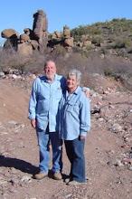
Well, some of you have asked for pictures of us. (*you may be sorry) We've compiled an album of photos taken over the years in various locations.   

*Caution, these photos have been shown to cause nausea in laboratory animals.


After reviewing these photos, I'm reminded of the lyrics to an old song:

Side By Side

Well we ain't got a barrel of money...
We may look ragged and funny...
But we're travelin' on...
Singing our song...
Side by side.

Through all kinds of weather...
What if the sky should fall?
As long as we're together,
It doesn't matter at all.

So we ain't got a barrel of money...
We may look ragged and funny...
But we're travelin' on...
Singing our song...
Side by side.

Through all kinds of weather...
Drought, flood, rain and snow,
We will be together...
So it just don't matter at all...

Oh we ain't got a barrel of money...
We may look ragged and funny...
But we're travelin' on...
Singing our song...
Side by side.

Don't know what's comin' tomorrow...
maybe it's trouble and sorrow...
but we'll travel the road...
sharin' our load...
side by side.

Oh we ain't got a barrel of money...
We may look ragged and funny...
But we're travelin' on...
Singing our song...
Side by side.

When they've all had their quarrels and parted...
we'll be the same as we started...
just travlin' along singin' a song...
side by side.

Written by Harry Woods (1947) 

Sunday, February 25, 2007

Richmond Basin Exploring

2/25/07

We've finally got some fantastic weather happening here in Arizona. Sunny and cool, perfect for exploring the backroads!

We went to Richmond Basin yesterday with Larry & Jean.The road is a great one for Jeeping, not too tippy, (well, maybe in a few places) some pretty good canyon drop-offs to keep us on our toes and gripping the seats. The views were spectacular.


So much mining took place in Richmond Basin, with huge operations beginning in the 1800s. The largest being the Silver King Mine. (A German prospector looking for gold traded his claims for a mule, the Silver King and Silver Nugget Mines turned out to be the most profitable silver mines ever worked)
In the book "History of Arizona and New Mexico, 1530-1888," By Hubert Howe Bancroft and Henry Lebbeus Oak, they wrote, "The Silver King lode differs from any other known, being a circular chimney of ore, with thousands of veins centring <sic> in it. The mine has a depth of over 800 feet, and though the ores are refractory, the production has been over $6,000,000. in silver". (this was in 1889 dollars)
Today, little remains of the camp which once employed up to 700 miners working the Silver King and surrounding mines. Standing on the mesa overlooking the Richmond Basin you can still see where the majority of workers and their families once lived. Vague remnants of structures and stone outlines are all that remains. Scattered throughout the Richmond Basin area are quite a few sample digs, deep, ominous looking vertical shafts, crumbling headframes, remnants of stamp mills, bridges, tailings, sample cores and roads that no longer lead anywhere.
There were several modern-day claim markers in the area, probably people still looking for gold as evidenced by the black sand piles we saw. There is silver ore imbedded in many of the tailings we found, but of course it wouldn't be profitable to try to recover it due to the high cost of silver reclamation and today's silver prices.


The Richmond Basin area would be an ideal spot to camp and take a few days to fully explore what's left. The scenery is some of the best we've seen in Arizona, mountain views, huge canyons and clean, crisp air.

Monday, February 19, 2007

Richmond Basin, 1st Visit.

2/19/07
Finally, the rain held off long enough for us to get out in the Jeep today ... whew ... we barely escaped contracting serious case of cabin fever.
We've been reading about Richmond Basin so we decided to check out the area. There are several old silver mines in the area and we knew we'd have to make several trips there to explore it fully. We weren't disappointed at all. The beautiful scenery combined with the great Jeep trails was worth the effort. The trail in was a gradual climb through a dry riverbed up into the mountains, nothing off camber or tippy. There were a few minor washouts from the recent rains, but all could be driven comfortably. There were quite a few different trails to take, but we stayed on just a couple of them, we'll go back and explore the others as soon as the weather stays nice for a few days. We'll see if we can locate on an old map the exact location of The Silver Nugget and Silver King Mines and then try to find whatever is left of them.
It was so good to be able to get out in the Jeep again. Even as I write this, it's raining again but the weather reports are calling for clearing. Somebody please remind the National Weather Service that this IS a desert!  Send us some sunshine please.

Saturday, February 17, 2007

Muddy Road Blues

2/17/07
It's rained here on and off for about a week or so, finally stopping just a few days ago. Of course during that time we didn't give much thought to it, knowing we need the moisture, especially out here in the desert. With no rain and snow in the higher elevations there wouldn't be water runoff into Roosevelt Lake, and no runoff means lower lake levels, pretty much setting off a draught phase in the surrounding areas. We simply hunkered down and spent some time indoors, doing the things people do when it's too wet to plow.
Well, finally we've got some sunshine so we decided to head for the backroads and some Jeeping, we were beginning to experience withdrawal symptoms such as fondling the Jeep keys and looking longingly at it as it sat parked...poor Jeep...it looks so forlorn. (so do we)
We thought we'd check out some of the roads up in the mountains of Greenback Valley. WRONG...even a Jeep can't handle the mud we encountered on our ride up the mountain, The AT tire treads quickly filled up and we slipped and slid so much we decided to turn around and head back home. We didn't want to hit the higher elevations with sheer drop offs and experience sliding where there wasn't room for error. By the time we got back home, the poor Jeep was so caked with mud, it took about an hour to hose it off and get the mud from the tire treads. Next time we'll probably buy some mud tires, this business of waiting for the roads to dry out really SUX!!! We've got places to go and things to see, hopefully Mother Nature will take pity on us old peeps and let the roads become passable before too much longer. Just last night Ralph was muttering in his sleep, "Baby, just slip it into four wheel low"...I guess he wasn't dreaming about me. 
Hmmm maybe today we can go sit in the Jeep and pretend.....

Sunday, February 11, 2007

Billy Goats And Rainbows

2/11/07
We've decided on one of our next destinations and set out this morning to check out the area. The clouds looked threatening and we knew we probably wouldn't be heading out across the desert but we wanted to scope out the area and locate the Jeep trail we'd need to take when the weather is clear. We've learned early on that when it's raining in a particular area, you don't want to be Jeeping in a dry riverbed when the rains come. What was once dry can quickly turn into a raging river in an instant.
We found the Jeep trail that we were looking for to take us to Richmond Basin. Richmond basin was the site of some pretty extensive silver mining and was the location of The Silver Nugget Mine. A German gold prospector was the first to stake a claim at the Silver Nugget. He didn't think it looked like a worthwhile gold claim so he traded it to a couple of other prospectors for a mule. The Silver Nugget Mine turned out to be one of the largest silver producers in the country. (sure hope the mule was a good one) There are several other abandoned mines in that same area, so it looks like it'll be a fun place to explore.
One the way back it started to rain as we predicted so we just drove around a bit a snapped a few pictures. A small herd of goats caught our attention, particularly the newborn goat standing on wobbly legs trying to nurse his Mommy Goat. By the time we got home it was raining fairly heavy, but we were rewarded with a rainbow promising a clearer day for Jeeping in the near future.  

Saturday, February 10, 2007

Jeeping FR1070 & FR225. The good, the bad and the dead.

 2/10/07
We decided to just do a bit of Jeeping this morning so we headed to an area nearby that we've passed but never explored. Riding through the dry riverbeds usually proves to be a good ride with some nice scenery, this one was no exception. The one thing we haven't encountered before was the sight of dead cattle. From the looks of the dead steers, they were probably shot by an irresponsible hunter or an idiot who had nothing better to do with his rifle. (I could think of a few things I'd like to do with his rifle) They're probably the same witless wonders who don't think twice about dropping empty beer cans and trash on the ground in a pristine wilderness...but that's a whole other topic, we'll save that for a day when I feel like climbing on my soapbox. This is exactly the sort of thing the freakin' "Greenies" would use to make their case for road closures. We did see a herd of steers who gave us the once over as we paused to take their pictures. Other than the sight of steer carcasses, the scenery was beautiful, we'll return to the area and ride it again, perhaps with another Jeep along for safety since the road seems to head off into more remote areas.
 
There's not a day that goes by that we don't stop to consider how fortunate we feel to live in an area we can enjoy on a daily basis...yep, it's almost heaven.


Wednesday, February 7, 2007

So Long Journigan

2/7/07
The good news is, we found Journigan Mine, the bad news, there's nothing left except piles of tailings. The topo map showed two adits and a vertical shaft. All gone, caved in and covered over. The tailings and dump look interesting so we'll go back and pick through those.
Kudos to Quentin Johnson a super Ranger with the Tonto National Forest who took time from his busy day to head out this morning armed with maps and GPS to help us locate the mine. In a couple of weeks, he'll go with us again to find Saguaro Mine, another one that's difficult to locate because there are no longer any trails or roads leading to it. We're fortunate to have such good Rangers in our neck of the woods, they're a great group of caring people.
It was disappointing to say the least, but we can now check off another mining camp from our list of mines in Gila County...only 740 more to go.

200 feet up where?
Name:  Quentin Journigan Search 005.jpg
Views: 1
Size:  32.9 KB
Nothing left, too bad.
Name:  Quentin Journigan Search 004.jpg
Views: 1
Size:  55.3 KB

Sunday, February 4, 2007

Yikes, what a hike!

 2/4/07
What started out as just another day searching for Journigan Mine (we STILL didn't find it) turned into a major trek. We've been studying the maps trying to figure out where the mine is located. The area is extremely remote so it's not like there's a road, or even a bunny trail leading to the mine. Well, we decided to try another approach by walking up a dry riverbed which seems to head in the direction we want to go. We had hoped the riverbed would be a fairly easy walk but that wasn't to be the case. It was completely covered in rocks so needless to say, it made for some really strenuous uphill hiking. We went up the wash for about two miles, needing to be two and a half miles before we would be in proximity of the mine, but the going got too rough and because we had to allow time to get out, we were forced to turn around. We've got time constraints because of our pooch Bailey waiting at home for us with his legs crossed and his back teeth floating.
Coming back down the wash was as difficult as hiking in because we had to watch our footing closely, we couldn't imagine how we'd get out of there if one of us broke a bone, or even sprained an ankle.
We paused on the way back to the Jeep to examine an enormous old Saguaro. We'd never seen one as huge as this one. We estimated it to be at least fifty feet tall with more arms than we'd ever seen before on any Saguaro. We sure wish it could tell us the tales of all the things it had witnessed in it's several hundred years of life...it probably even knows where Journigan Mine is but it's not telling!